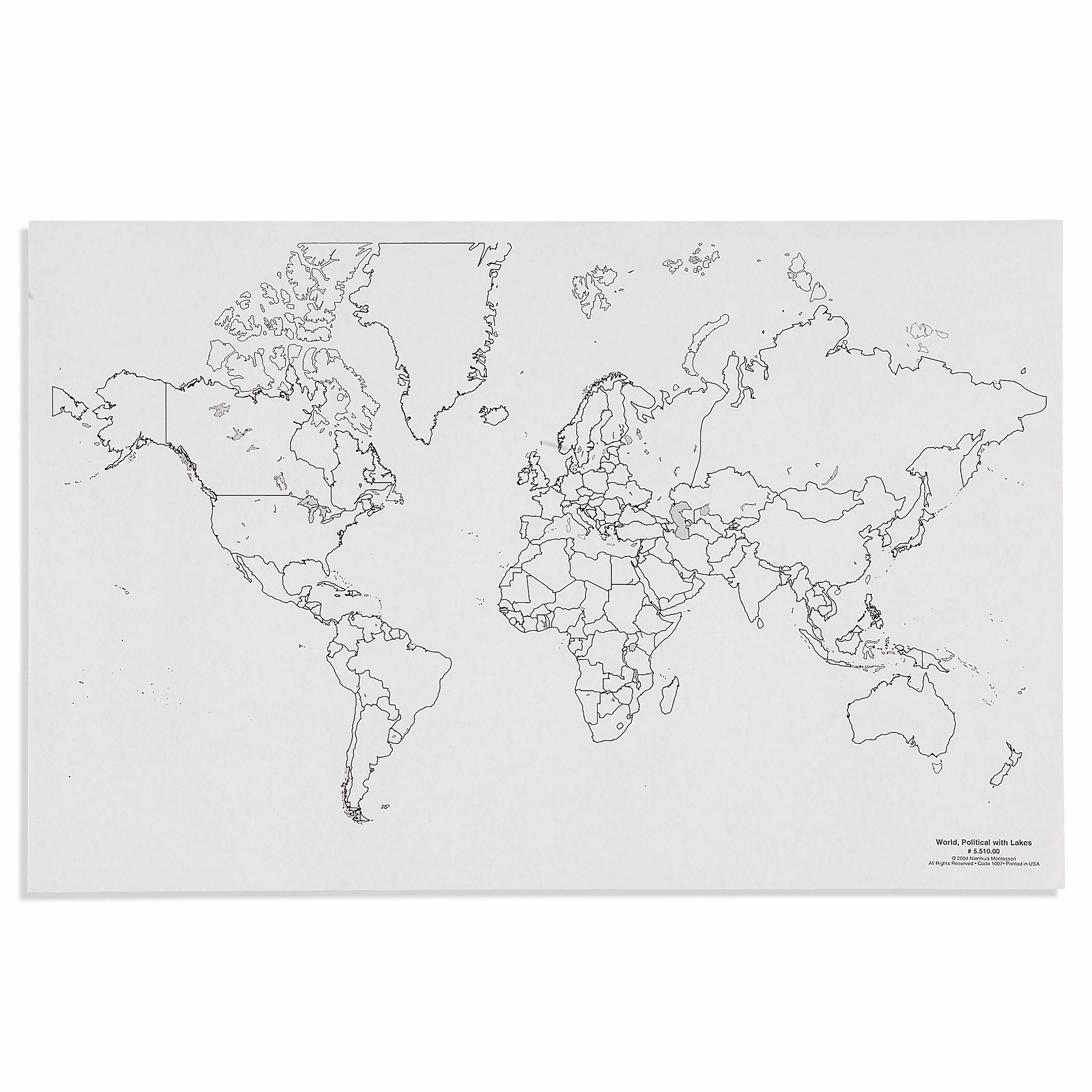
The World: Political With Lakes (50) is a Educational Materials Montessori material designed for children aged 3-6, crafted by Nienhuis Montessori to AMI standards.
This unlabeled political world map showcases country borders and major lakes, serving as a foundational material for geography work in the Cultural Studies curriculum. The clear delineation of political boundaries and water bodies allows children to explore global geography through hands-on activities like pin maps, flag work, and continent studies.
“The child is both a hope and a promise for mankind.”— Maria MontessoriEducation and Peace
“The hands are the instruments of man's intelligence.”
— Maria Montessori, The Absorbent Mind
The World: Political With Lakes map introduces young children to Earth's political divisions through an unlabeled format that invites active exploration. This political world map with its clear country borders and major lakes creates opportunities for children to build mental maps of our world through repetition and sensorial engagement. In Montessori geography, unlabeled maps come before labeled ones, allowing children to focus on shapes, relationships, and patterns without the distraction of text. The inclusion of lakes alongside political boundaries helps children understand how natural features interact with human-made divisions. This map serves as a canvas for pin work, where children physically place markers to identify countries they're studying, creating muscle memory alongside visual recognition. The political boundaries shown on this foundational geography material help children grasp the concept that Earth is divided into distinct nations, each with its own culture, flag, and identity.
Each order includes everything needed for proper presentation and long-term use.
Follow the Montessori method of presentation for optimal child development.
Invite the child to explore the map freely, tracing country borders with their finger
Select one country and place a pin in it, naming the country aloud
Add pins to neighboring countries, discussing how they share borders
Identify major lakes and place blue pins to mark them
Every material is carefully selected for durability, safety, and authentic Montessori experience.
Sourced from sustainably managed European forests. Beechwood is chosen for its exceptional durability, smooth grain, and natural warmth that invites touch.
Natural, unbleached cotton in child-friendly colors. The fabric provides the right amount of friction for developing fingers while being gentle on sensitive skin.
Water-based, child-safe finish that meets the strictest European safety standards. Designed to withstand years of daily use without chipping or peeling.
Each material supports multiple areas of child development simultaneously.
Builds understanding of political boundaries, countries, and continents while developing spatial reasoning skills.
Supports exploration of world cultures by providing a visual framework for studying different countries and regions.
Enhances precision through activities like placing pins, tracing boundaries, or labeling countries.
Develops ability to understand symbolic representation as children connect the map to real-world geography.
Designed for child-sized hands
Professional tips from AMI-trained guides to maximize the educational value of this material.
“Start with continents the child already knows from puzzle maps before introducing individual countries”
Use the map for group lessons about current events, helping children locate countries in the news
Create matching cards with country outlines for children to practice shape recognition away from the map
Incorporate cultural objects or photographs when studying specific countries marked on the map
Everything you need to know about this material.
The unlabeled design allows children to focus on visual recognition of shapes and boundaries without text distractions. The clear political borders and lakes provide concrete geographical features that young children can trace, color, and identify through hands-on activities appropriate for their developmental stage.
Children use this map as a control chart for pin maps, matching country flags to locations, tracing borders, and identifying major water bodies. It serves as a reference for continent boxes, cultural folders, and extends into lessons about people, animals, and landmarks of different countries.
The number 50 typically indicates the scale or size specification of the map, though specific dimensions should be confirmed with the manufacturer. This ensures the map is appropriately sized for classroom use and compatible with other Montessori geography materials.
Unlabeled maps follow the Montessori principle of isolating difficulty. Children first learn to recognize shapes, borders, and geographical features visually before adding the complexity of reading names. This allows non-readers to engage with geography and supports the development of visual discrimination skills.
Children can create pin maps with colored flags, trace countries onto paper, match country puzzle pieces to the map, sort pictures or objects by continent, and use it as a reference for cultural studies about foods, animals, clothing, and celebrations from different nations.
Can't find what you're looking for?
Contact Our Experts
Share your experience with this material and help other educators and parents.


