The World: Political (50) is a Educational Materials Montessori material designed for children aged 3-6, crafted by Nienhuis Montessori to AMI standards.
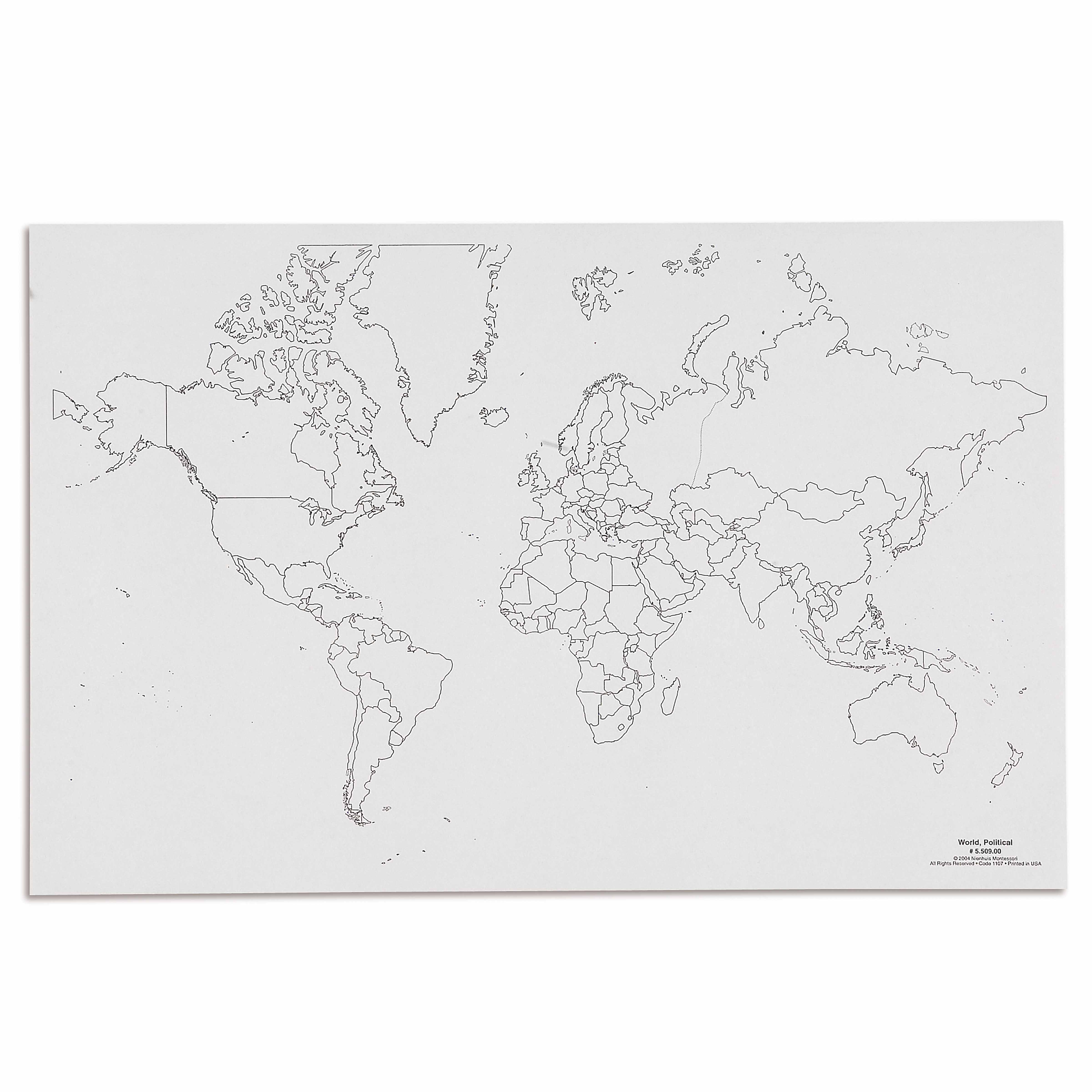
This political world map introduces children to global geography through a clear outline format showing country boundaries and continent divisions. The unlabeled design encourages active learning as children identify and name countries independently, supporting the Montessori approach to concrete geographical understanding through visual exploration.
“The child is both a hope and a promise for mankind.”— Maria MontessoriEducation and Peace
“The hands are the instruments of man's intelligence.”
— Maria Montessori, The Absorbent Mind
The Political World Map (50) addresses the young child's profound need to understand their place within the wider world. This unlabeled political map presents country boundaries and continental divisions through clear visual outlines, allowing children to build geographical knowledge through repeated exploration. The map's design respects the child's capacity for visual discrimination while introducing abstract political boundaries in concrete form. Through tracing countries and locating familiar places, children develop spatial awareness alongside cultural understanding. The Political World Map serves as a foundation for discussions about different peoples and places, satisfying the child's natural curiosity about the world beyond their immediate environment. Its unlabeled format transforms geography from rote memorization into active discovery, where each country outline becomes a puzzle piece in understanding global interconnections.
Each order includes everything needed for proper presentation and long-term use.
Follow the Montessori method of presentation for optimal child development.
Invite the child to explore the map, starting with locating their own country
Identify and trace the seven continents using different colors
Choose three countries the child knows about and locate them together
Practice directional language: 'Find a country north of...'
Every material is carefully selected for durability, safety, and authentic Montessori experience.
Sourced from sustainably managed European forests. Beechwood is chosen for its exceptional durability, smooth grain, and natural warmth that invites touch.
Natural, unbleached cotton in child-friendly colors. The fabric provides the right amount of friction for developing fingers while being gentle on sensitive skin.
Water-based, child-safe finish that meets the strictest European safety standards. Designed to withstand years of daily use without chipping or peeling.
Each material supports multiple areas of child development simultaneously.
Introduces world geography concepts and develops understanding of Earth's political divisions through visual recognition.
Strengthens ability to distinguish between different country shapes and continental boundaries.
Encourages memorization of country locations and names through repeated identification practice.
Provides foundation for discussions about different cultures, languages, and peoples around the world.
Designed for child-sized hands
Professional tips from AMI-trained guides to maximize the educational value of this material.
“Display the map at children's eye level for spontaneous exploration throughout the day”
Connect map work to current events or classroom visitors from other countries
Use the map during circle time to show where stories or songs originate
Keep a basket of small flags or markers for children to place on countries they're learning about
Everything you need to know about this material.
This political world map is specifically designed for children ages 3-6 years old, perfectly aligned with the Montessori early childhood curriculum for introducing geography concepts.
The unlabeled design follows Montessori principles, encouraging children to actively engage in learning by identifying and naming countries independently, which promotes deeper understanding and memory retention.
The (50) typically indicates the scale or size specification of the map, helping you identify the specific dimensions suitable for classroom or home use.
Children can trace country boundaries with their fingers, match the map with labeled control charts, use it with flag materials, and gradually learn country names through repetition and hands-on exploration.
This political map shows country boundaries and continental divisions, focusing on human-made borders, while physical maps show natural features like mountains, rivers, and terrain.
Can't find what you're looking for?
Contact Our Experts
Share your experience with this material and help other educators and parents.


