The World: Outline (50) is a Educational Materials Montessori material designed for children aged 3-6, crafted by Nienhuis Montessori to AMI standards.
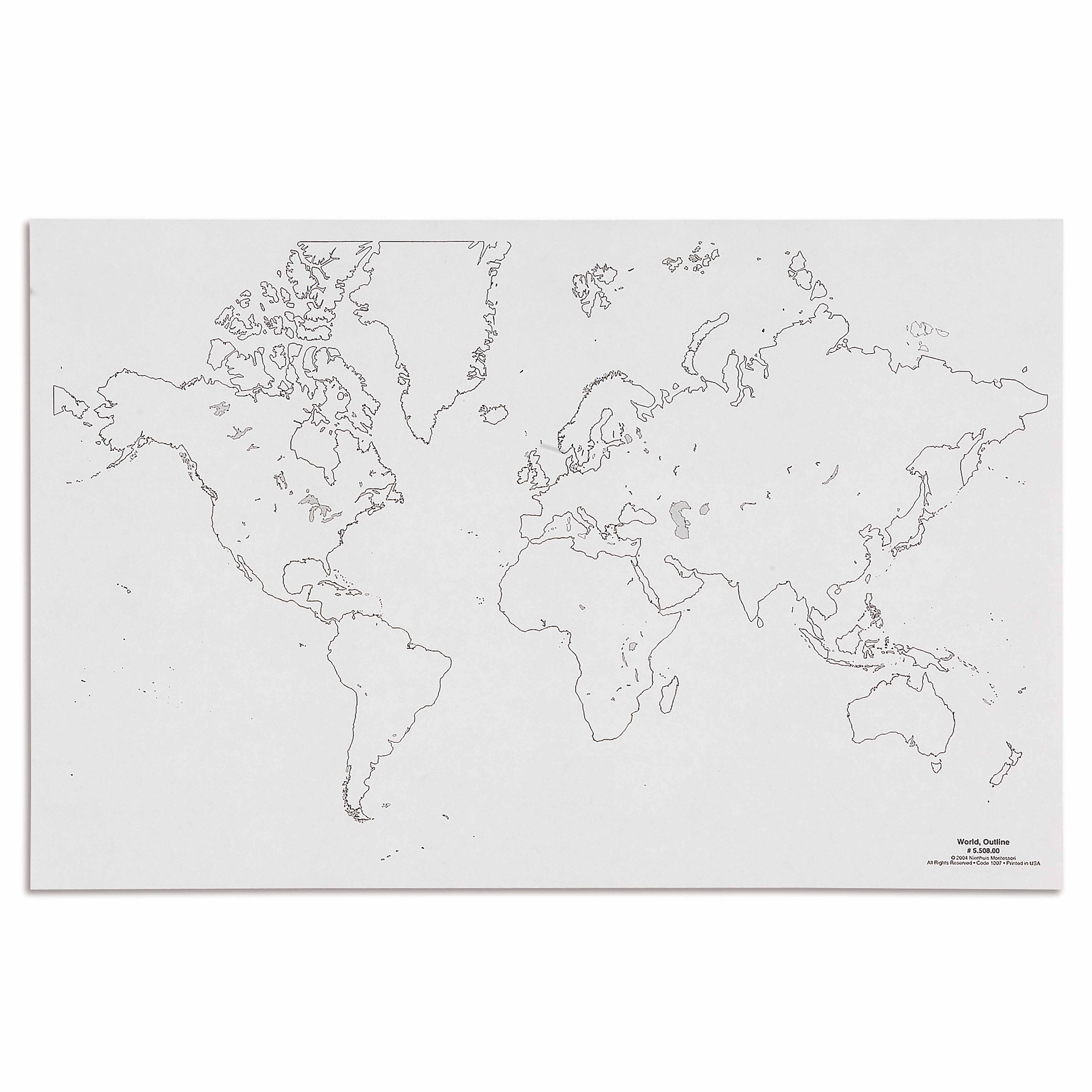
This World Outline poster presents a clear, uncluttered view of Earth's continents and countries, perfect for introducing young learners to global geography. The high-contrast black outlines on white background support the Montessori approach to map work, allowing children to trace, color, and explore world geography at their own pace.
“The child is both a hope and a promise for mankind.”— Maria MontessoriEducation and Peace
“The hands are the instruments of man's intelligence.”
— Maria Montessori, The Absorbent Mind
The World Outline poster serves as the foundation for the Geography curriculum in the Montessori classroom, introducing children to Earth's continents through clear, uncluttered black lines on white background. This simplified presentation of world geography allows young learners to first perceive the whole before exploring the parts, following Maria Montessori's principle of moving from concrete to abstract understanding. The high-contrast outlines enable children to visually isolate each continent's shape, supporting their developing visual discrimination skills essential for later map work. By presenting only the essential boundaries without colors, labels, or additional details, this outline map respects the child's need for order and clarity during the sensitive period for geography between ages 3-6. The poster's design invites children to actively engage through tracing, coloring, and creating their own representations of Earth's land masses, transforming passive observation into dynamic exploration of our planet's physical structure.
Each order includes everything needed for proper presentation and long-term use.
Follow the Montessori method of presentation for optimal child development.
Invite the child to observe the poster, pointing to each continent's outline without naming them
Demonstrate tracing one continent outline with your finger, moving slowly and deliberately
Offer tracing paper for the child to place over the poster and trace continent outlines
Introduce continent names using three-period lesson after child knows shapes well
Every material is carefully selected for durability, safety, and authentic Montessori experience.
Durable paper stock chosen for its ability to withstand repeated handling, tracing activities, and coloring work typical in Montessori geography lessons.
Each material supports multiple areas of child development simultaneously.
Introduces fundamental concepts of continents, countries, and spatial relationships on a global scale.
Tracing continent and country outlines strengthens pencil control and hand-eye coordination.
Helps children understand that maps represent real places, bridging concrete and abstract thought.
Lays groundwork for cultural studies by providing visual framework of world geography.
Designed for child-sized hands
Professional tips from AMI-trained guides to maximize the educational value of this material.
“Display the outline poster before introducing any colored or labeled world maps”
Create pin-punching activities using photocopied continent outlines from the poster
Use the poster for group lessons on Earth's land and water distribution
Reference the outline poster when transitioning to political or physical geography maps
Everything you need to know about this material.
The poster measures 50cm, providing a large, clear view of continents and countries that's perfectly sized for classroom walls or home learning spaces.
Children can trace continents with their fingers, color different countries, label oceans and continents, and use it as a reference for pin-mapping activities and cultural studies.
Yes, the simple black and white design is perfect for young children. Three-year-olds can start by identifying land and water areas, while older children progress to naming continents and countries.
The poster works well with colored pencils, crayons, or washable markers. If laminated, children can use dry-erase markers for repeated practice.
Yes, the uncluttered design aligns with Montessori principles by presenting clear, accurate information without overwhelming details, allowing children to build knowledge progressively.
Can't find what you're looking for?
Contact Our Experts
Share your experience with this material and help other educators and parents.


