The United States: State Boundaries (50) is a Educational Materials Montessori material designed for children aged 3-6, crafted by Nienhuis Montessori to AMI standards.
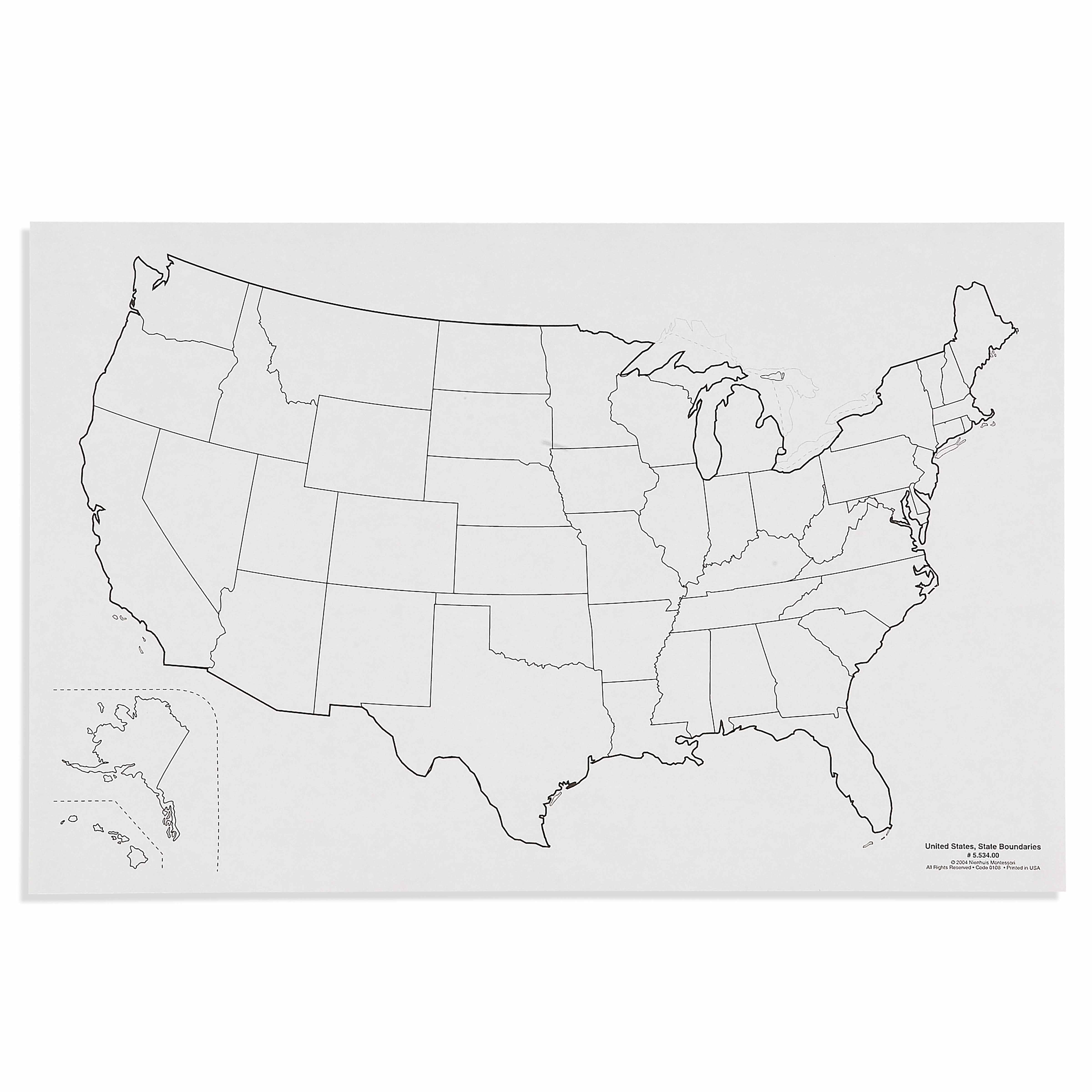
This laminated United States map presents all 50 state boundaries with clear black outlines on a white background, offering children a visual introduction to American geography. The durable 60×40cm format allows for repeated tracing activities and serves as a reference for labeling exercises, with Alaska and Hawaii thoughtfully positioned for complete geographical awareness.
“The child is both a hope and a promise for mankind.”— Maria MontessoriEducation and Peace
“The hands are the instruments of man's intelligence.”
— Maria Montessori, The Absorbent Mind
The United States State Boundaries map enters the Montessori classroom as young children demonstrate readiness to understand their place within larger communities. This 60×40cm laminated map with its stark black boundary lines on white background serves the child's need for clarity and order when first encountering abstract political divisions. In Montessori geography, the state boundaries map bridges the gap between concrete sensorial experiences with puzzle maps and abstract understanding of invisible borders. The laminated surface invites repeated tracing, allowing the child to internalize shapes through movement - a fundamental Montessori principle. By presenting all 50 states including Alaska and Hawaii in their relative positions, this map respects the child's need for complete, accurate information. The clear black outlines eliminate distracting details, focusing attention solely on boundary shapes. This simplified presentation aligns with Montessori's isolation of difficulty principle, allowing children to master state recognition before adding complexities like capitals or geographical features.
Each order includes everything needed for proper presentation and long-term use.
Follow the Montessori method of presentation for optimal child development.
Introduce the map by tracing the entire United States outline with your finger, moving slowly and deliberately
Select one state with a distinctive shape (like Texas or Florida) and trace its boundary three times
Invite the child to trace the same state boundary with their finger, then with a dry-erase marker
Place tracing paper over the state and trace the boundary with pencil
Compare the traced shape to the original, discussing what makes this state's shape unique
Every material is carefully selected for durability, safety, and authentic Montessori experience.
Sourced from sustainably managed European forests. Beechwood is chosen for its exceptional durability, smooth grain, and natural warmth that invites touch.
Natural, unbleached cotton in child-friendly colors. The fabric provides the right amount of friction for developing fingers while being gentle on sensitive skin.
Water-based, child-safe finish that meets the strictest European safety standards. Designed to withstand years of daily use without chipping or peeling.
Each material supports multiple areas of child development simultaneously.
Introduces children to the concept of states and boundaries while developing spatial understanding of the United States.
Tracing state outlines strengthens pencil grip and hand control essential for writing preparation.
Recognizing and distinguishing between different state shapes enhances visual perception abilities.
Builds foundational understanding of American geography and political divisions appropriate for the absorbent mind.
Designed for child-sized hands
Professional tips from AMI-trained guides to maximize the educational value of this material.
“Present this map after children have worked extensively with the Montessori puzzle map of the United States”
Create a basket of pre-cut tracing papers sized for individual states to encourage independent work
Laminate traced states for matching activities with the boundary map
Use the map horizontally on the floor for group lessons, allowing multiple children to work simultaneously
Everything you need to know about this material.
This map is designed for ages 3-6, introducing young children to US geography through visual learning. The simple black outline format makes it accessible for preschoolers while providing enough detail for early elementary students.
Children can trace state boundaries with dry-erase markers, practice state recognition, label states with removable stickers, and use it as a reference for puzzle work. The laminated surface allows for repeated use without damage.
The map measures 60×40cm (approximately 24×16 inches) and is printed on durable laminated material. The lamination protects against spills and allows for easy cleaning after hands-on activities.
Yes, all 50 states are included. Alaska and Hawaii are thoughtfully positioned on the map to provide complete geographical awareness while maintaining proper visual representation of the continental United States.
This map aligns with Montessori principles by providing a concrete, visual representation of abstract geographical concepts. It serves as a control map for puzzle work and supports sequential learning from whole (country) to parts (individual states).
Can't find what you're looking for?
Contact Our Experts
Share your experience with this material and help other educators and parents.


