The United States Map — 50 Colour-Coded Location Set is a Sensorial Montessori material designed for children aged 3-6, crafted by Nienhuis Montessori to AMI standards.
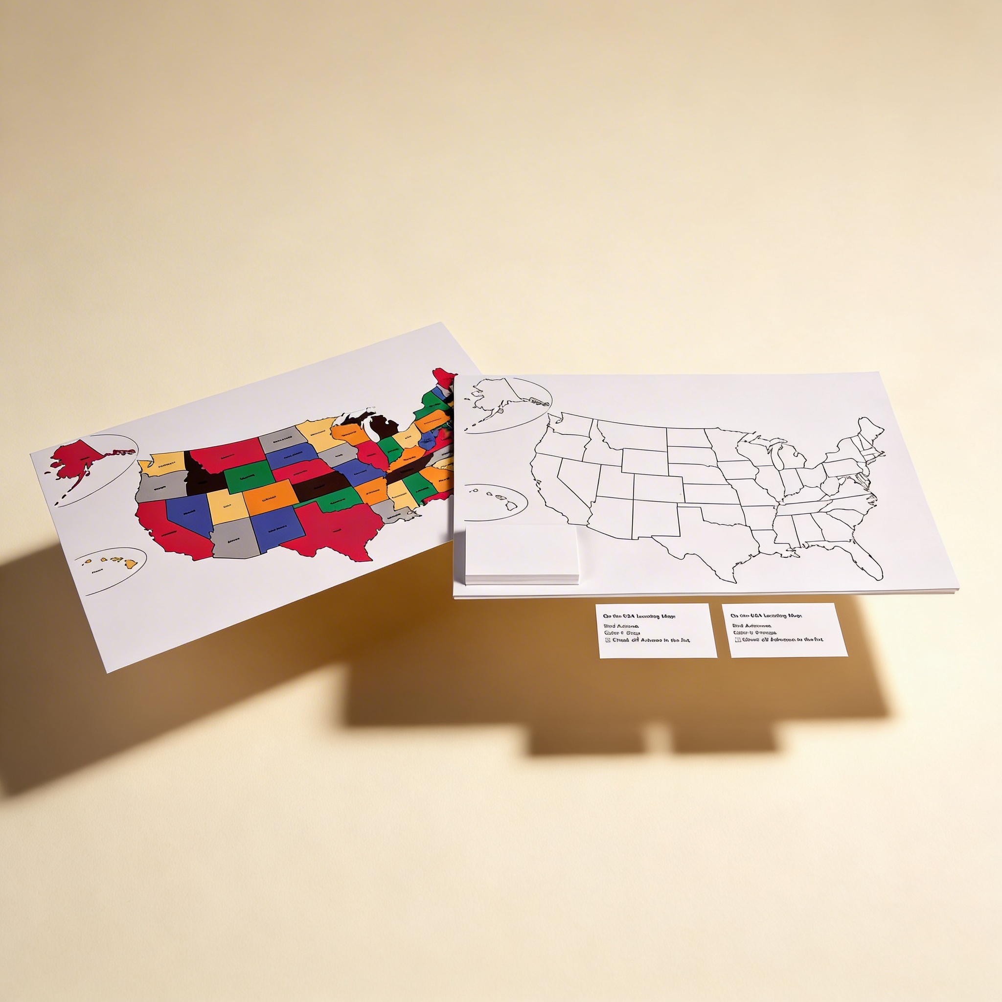
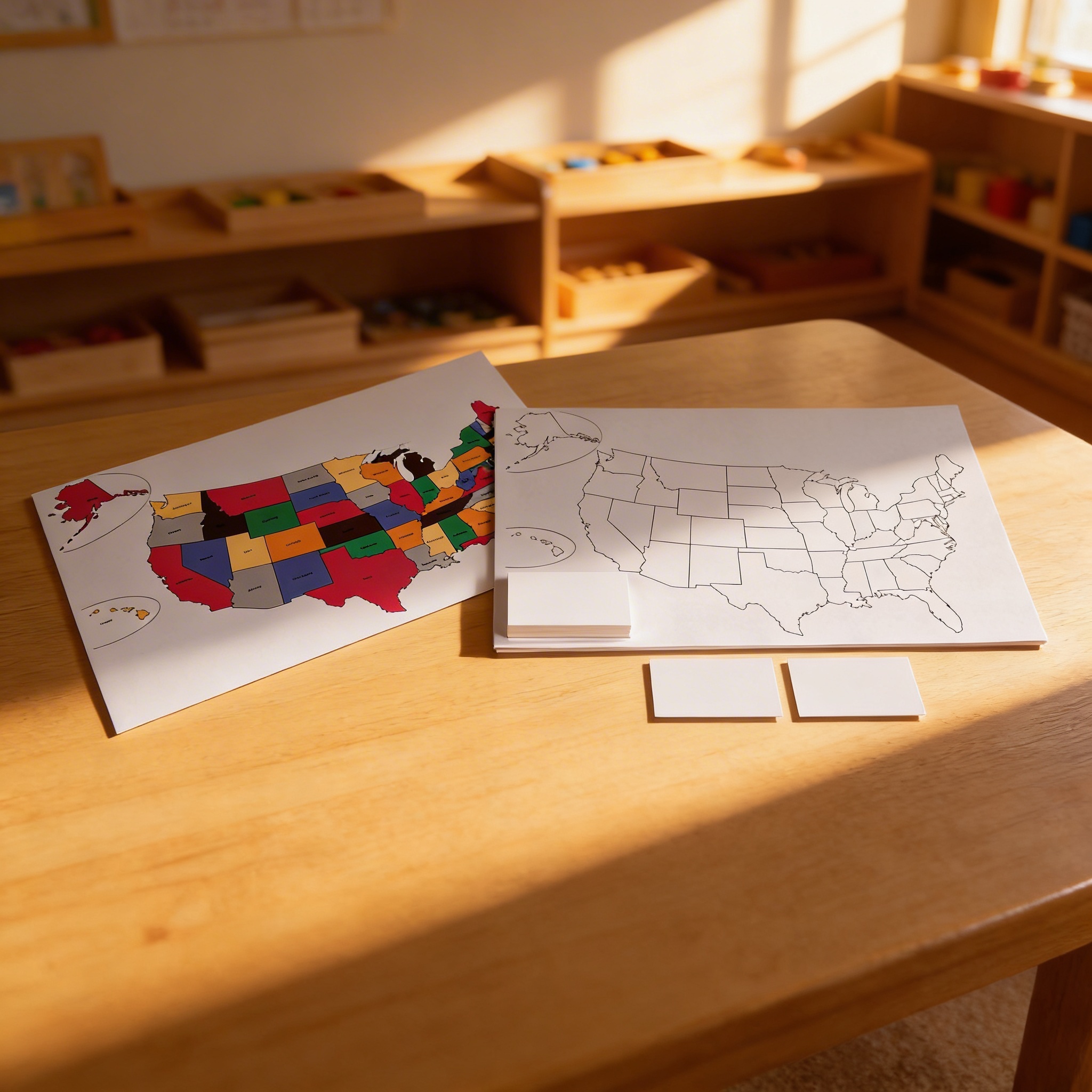
This comprehensive United States Location Color Set introduces children to American geography through color-coded states and interactive matching activities. The material includes a vibrant colored map, blank practice map, and corresponding location cards, enabling children to develop spatial awareness and geographical knowledge through hands-on exploration and self-correction.
“The child is both a hope and a promise for mankind.”— Maria MontessoriEducation and Peace
“The hands are the instruments of man's intelligence.”
— Maria Montessori, The Absorbent Mind
This material embodies Montessori's principle of the 'Cosmic Curriculum,' introducing children to their place in the world through concrete, sensorial experiences. The color-coding transforms abstract geographical concepts into tangible, visual learning that appeals to the child's sensitive period for order and classification. Through self-directed exploration with the maps, children construct their own understanding of spatial relationships and cultural geography. The material's self-correcting nature honors the child's drive for independence and precision, while the progression from concrete (colored map) to abstract (blank map) follows Montessori's fundamental teaching sequence. This work prepares the child's absorbent mind for later cultural studies while developing concentration, visual discrimination, and fine motor control through purposeful activity.
Each order includes everything needed for proper presentation and long-term use.
Follow the Montessori method of presentation for optimal child development.
Invite the child to explore the colored map, tracing state boundaries with their finger
Select one location card and find the matching colored state on the reference map
Place the location card on the corresponding space of the blank map
Continue matching cards, building from familiar to unfamiliar states
When complete, verify placement using the colored map for self-correction
Every material is carefully selected for durability, safety, and authentic Montessori experience.
Durable laminated surface allows repeated use and easy cleaning, essential for classroom environments where materials are handled frequently by young learners.
Each material supports multiple areas of child development simultaneously.
Children develop understanding of spatial relationships and location through visual discrimination of color-coded states.
Matching activities strengthen visual memory and pattern recognition as children associate shapes with locations.
State name cards provide meaningful reading practice with concrete geographical context.
Self-correcting materials allow children to work autonomously and verify their own work.
Designed for child-sized hands
Professional tips from AMI-trained guides to maximize the educational value of this material.
“Present this material after the child has worked with puzzle maps of continents to establish geographical hierarchy”
Create a peaceful atmosphere by limiting the number of children working with maps simultaneously
Rotate which states are emphasized based on children's personal connections or current events
Store the material at child-height with all components clearly visible to promote independent choice
Everything you need to know about this material.
The set includes a vibrant color-coded map of the United States, a blank practice map for children to fill in, and 50 corresponding location cards representing each state. All materials are designed for hands-on exploration and self-correction.
This material follows Montessori principles by providing concrete, hands-on learning experiences. Children can physically match state cards to the map, supporting self-directed learning and allowing for self-correction through the control of error built into the color-coding system.
Children develop spatial awareness, visual discrimination, fine motor skills, and geographical knowledge. They also enhance memory, concentration, and map-reading abilities while learning to identify and locate all 50 states through color association.
Start by showing the colored map and naming a few states. Demonstrate matching one or two state cards to their locations. Allow the child to explore at their own pace, gradually working with more states. The blank map can be introduced once the child shows confidence with the colored version.
Yes, this set perfectly complements other Montessori geography materials such as puzzle maps, land and water forms, and continent boxes. It serves as an excellent progression from continent work to more detailed country-specific geography study.
Can't find what you're looking for?
Contact Our Experts
Share your experience with this material and help other educators and parents.
Bundle related materials and save. Free curriculum guide included with every set.


