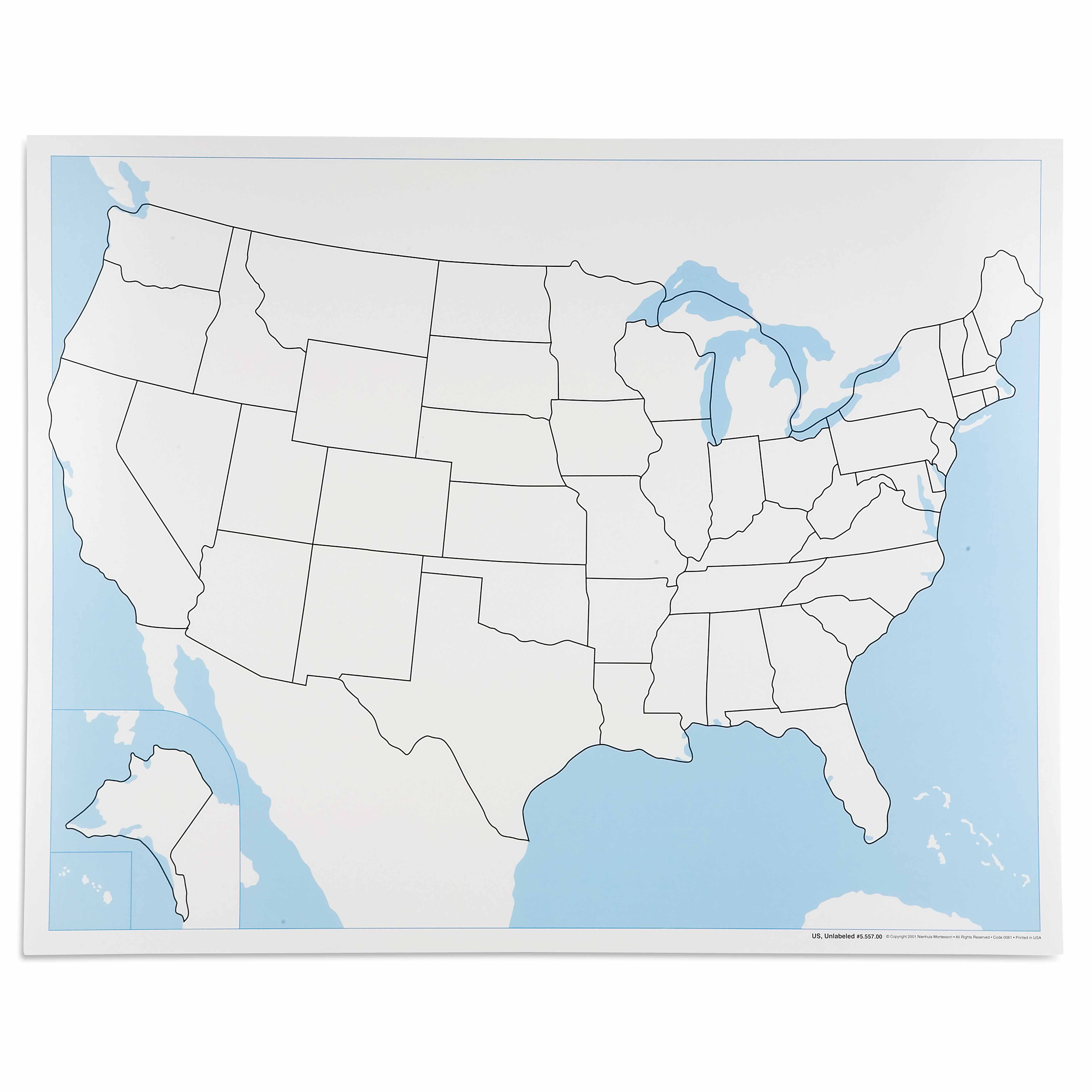
The United States Control Map: Unlabeled is a category.geography Montessori material designed for children aged 3-6, crafted by Nienhuis Montessori to AMI standards.
This unlabeled United States Control Map serves as an essential Geography material for the 3-6 year classroom, featuring clearly defined state boundaries without names to support independent learning. The laminated surface includes all 50 states with Alaska and Hawaii properly positioned, allowing children to trace boundaries, match with labeled puzzle pieces, and develop spatial awareness of their country through repeated practice.
“Education is a natural process spontaneously carried out by the human individual, and is acquired not by listening to words but by experiences upon the environment.”— Maria MontessoriEducation for a New World
“The child is both a hope and a promise for mankind.”
— Maria Montessori, Education and Peace
The United States Control Map addresses the child's need to understand their place in the world through concrete, visual representation. This unlabeled map with its clearly defined state boundaries creates a visual puzzle that children solve through matching and tracing activities. By presenting all 50 states without names, the control map isolates the challenge of recognizing shapes and spatial relationships before introducing abstract symbols like text. The laminated surface of this geography material allows repeated exploration as children trace state outlines with their fingers, building muscle memory of each boundary. When children work with the United States Control Map alongside labeled puzzle pieces, they create their own discoveries about how states fit together like a giant puzzle. This unlabeled format respects the child's ability to recognize patterns and make connections independently, while the durable laminated construction ensures the map remains a reliable reference throughout their geographical explorations.
Each order includes everything needed for proper presentation and long-term use.
Follow the Montessori method of presentation for optimal child development.
Invite the child to trace the outline of the entire United States with their finger
Select one puzzle piece and show how to match its shape to the corresponding state on the control map
Place the puzzle piece directly on top of its matching state on the control map
Continue matching pieces one by one, allowing the child to work at their own pace
Once comfortable, introduce tracing individual state boundaries on the map with a finger
Every material is carefully selected for durability, safety, and authentic Montessori experience.
Sourced from sustainably managed European forests. Beechwood is chosen for its exceptional durability, smooth grain, and natural warmth that invites touch.
Natural, unbleached cotton in child-friendly colors. The fabric provides the right amount of friction for developing fingers while being gentle on sensitive skin.
Water-based, child-safe finish that meets the strictest European safety standards. Designed to withstand years of daily use without chipping or peeling.
Each material supports multiple areas of child development simultaneously.
Builds understanding of state boundaries and spatial relationships within the United States through visual recognition and tracing work.
Tracing state boundaries develops pencil grip and hand control while reinforcing geographic knowledge.
Working with unlabeled maps helps children internalize geographic concepts beyond mere memorization of names.
Matching puzzle pieces to control map boundaries requires sustained focus and attention to detail.
Designed for child-sized hands
Professional tips from AMI-trained guides to maximize the educational value of this material.
“Display the control map at child height on a wall when not in use for spontaneous reference”
Pair this material with the wooden puzzle map for a complete geography experience
Create a 'state of the week' routine where children trace and explore one state in detail
Keep a damp cloth nearby to clean the laminated surface after tracing activities
Everything you need to know about this material.
The control map is printed on durable, laminated material that can withstand repeated use by young children. The exact dimensions are designed to match standard Montessori geography materials and provide clear visibility of all 50 states including Alaska and Hawaii in their proper geographic positions.
Children use this control map as a reference guide when working with the United States puzzle map. They can trace state boundaries with their fingers, match puzzle pieces to the corresponding shapes, and use it for activities like coloring their own maps or placing labels during more advanced work.
The unlabeled design follows Montessori principles of isolation of difficulty. Children first learn to recognize states by shape and location without the distraction of text. This builds visual discrimination skills and spatial awareness before introducing reading components, making it perfect for pre-readers aged 3-6.
Yes, this control map is designed to complement the Montessori United States puzzle map, pin maps, and flag work. It serves as the master reference for checking work and can be used alongside labeled maps, state capital materials, and cultural folders for extended learning.
The laminated control map is designed primarily for table work where children can closely examine state boundaries and match materials. While it can be displayed, it's most effective when children can touch and trace the boundaries during hands-on geography activities.
Can't find what you're looking for?
Contact Our Experts
Share your experience with this material and help other educators and parents.


