The Spain Control Map: Unlabeled is a category.geography Montessori material designed for children aged 3-6, crafted by Nienhuis Montessori to AMI standards.
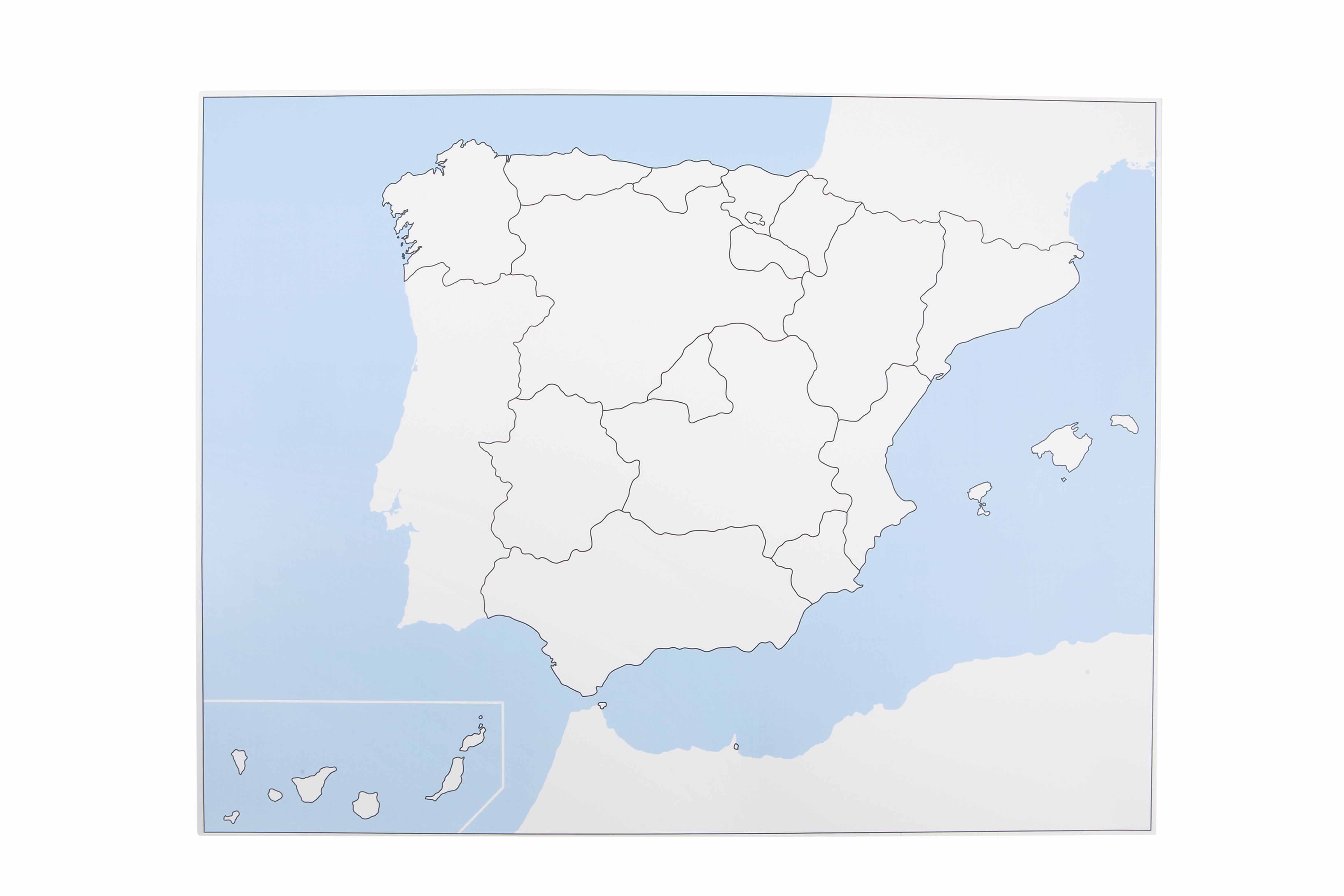
This unlabeled control map of Spain serves as a key reference tool in the Montessori geography curriculum, displaying all autonomous communities with clear boundary lines. The map includes mainland Spain, the Balearic Islands, and features an inset showing the Canary Islands' location, enabling children to verify their work with puzzle maps and develop spatial understanding of Spain's political divisions.
“Education is a natural process spontaneously carried out by the human individual, and is acquired not by listening to words but by experiences upon the environment.”— Maria MontessoriEducation for a New World
“The child is both a hope and a promise for mankind.”
— Maria Montessori, Education and Peace
The Spain Control Map serves as an essential reference point in the Montessori geography curriculum, providing children with a concrete tool for self-correction when working with Spain puzzle maps. This unlabeled map respects the child's developing visual discrimination by presenting only the essential information—autonomous community boundaries—without overwhelming text labels. The control map's clear boundary lines allow children to match puzzle pieces through shape recognition alone, building spatial intelligence through repeated comparison. By including the Balearic Islands and Canary Islands inset, this map presents Spain's complete political geography in an accessible format for young learners. The control map transforms abstract political divisions into tangible visual relationships that children can trace, compare, and internalize through hands-on work.
Each order includes everything needed for proper presentation and long-term use.
Follow the Montessori method of presentation for optimal child development.
Remove all pieces from the Spain puzzle map and place them randomly on the work mat
Select one puzzle piece and examine its shape carefully
Look at the control map to find the matching shape by scanning the boundaries
Place the puzzle piece in its correct position and verify against the control map
Continue until all pieces are correctly placed, using the control map for each piece
Every material is carefully selected for durability, safety, and authentic Montessori experience.
Sourced from sustainably managed European forests. Beechwood is chosen for its exceptional durability, smooth grain, and natural warmth that invites touch.
Natural, unbleached cotton in child-friendly colors. The fabric provides the right amount of friction for developing fingers while being gentle on sensitive skin.
Water-based, child-safe finish that meets the strictest European safety standards. Designed to withstand years of daily use without chipping or peeling.
Each material supports multiple areas of child development simultaneously.
Children develop keen observation skills by matching puzzle pieces to the control map's boundaries and shapes.
Understanding the relationship between mainland Spain and its island territories builds geographic awareness.
The unlabeled format encourages independent verification and builds confidence in map work.
Learning Spain's political divisions introduces concepts of regions and autonomous governance.
Designed for child-sized hands
Professional tips from AMI-trained guides to maximize the educational value of this material.
“Display the control map at child's eye level near the puzzle map shelf for easy access”
Laminate the control map for durability and to allow tracing with dry-erase markers
Create a matching exercise using photocopied individual regions from the control map
Use the control map for group lessons on Spanish geography before individual work
Everything you need to know about this material.
The map displays all autonomous communities of Spain with clear boundary lines, including mainland Spain, the Balearic Islands, and an inset showing the Canary Islands' location. It serves as a reference tool for children to check their work independently.
Children use this unlabeled control map alongside Spain puzzle maps to verify correct placement of pieces. It promotes self-correction, develops spatial awareness of Spain's political divisions, and supports independent learning without adult intervention.
The unlabeled design encourages children to focus on shapes and boundaries rather than reading. This approach is appropriate for ages 3-6, allowing pre-readers to work independently and develop visual discrimination skills while learning Spain's geography.
This control map pairs perfectly with Montessori Spain puzzle maps, allowing children to match puzzle pieces to the correct regions. It can also be used with tracing activities, coloring exercises, and pin maps for extended geography work.
While specific material details aren't provided, Montessori control maps are typically printed on sturdy cardstock or laminated for repeated classroom use. The map should withstand regular handling by young children during geography activities.
Can't find what you're looking for?
Contact Our Experts
Share your experience with this material and help other educators and parents.


