The South America: Political (50) is a category.geography Montessori material designed for children aged 3-6, crafted by Nienhuis Montessori to AMI standards.
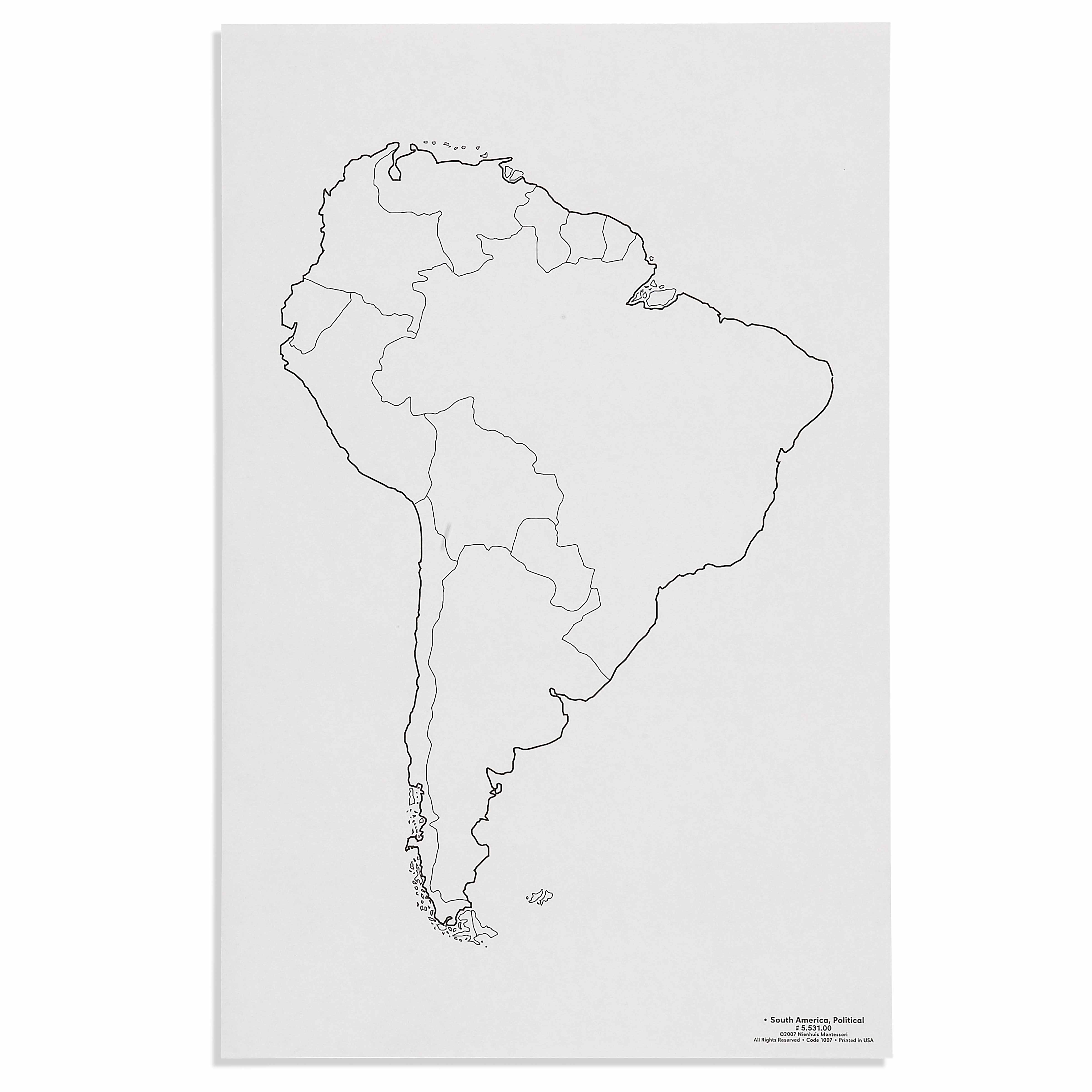
This political map of South America presents a clear outline of the continent with country borders, designed for the Montessori geography curriculum. The unlabeled format encourages children to explore and learn country names, shapes, and positions through hands-on activities with puzzle maps and other geography materials.
“Education is a natural process spontaneously carried out by the human individual, and is acquired not by listening to words but by experiences upon the environment.”— Maria MontessoriEducation for a New World
“The child is both a hope and a promise for mankind.”
— Maria Montessori, Education and Peace
The South America Political Map introduces young children to the distinct shapes and boundaries of South American countries through visual isolation and repetition. This unlabeled political map serves as a control chart for the puzzle map work, allowing children to match puzzle pieces to their corresponding outlines while building geographic awareness. The clear country borders on this map provide the visual reference point children need when working independently with three-dimensional puzzle pieces. Through repeated matching exercises between the political map and puzzle pieces, children absorb the unique shapes of Brazil, Argentina, Chile, and other nations before formal instruction begins. The map's simplified presentation removes distracting details like city names or terrain features, focusing attention solely on political boundaries. This political map bridges concrete puzzle work with abstract geographic concepts, preparing children to eventually locate and name countries independently.
Each order includes everything needed for proper presentation and long-term use.
Follow the Montessori method of presentation for optimal child development.
Invite the child to match one puzzle piece at a time to its outline on the political map
Show how to trace around each country's border with the index finger
Return the puzzle piece to its frame, checking against the political map
Repeat with remaining countries, working from largest to smallest
Every material is carefully selected for durability, safety, and authentic Montessori experience.
Sourced from sustainably managed European forests. Beechwood is chosen for its exceptional durability, smooth grain, and natural warmth that invites touch.
Natural, unbleached cotton in child-friendly colors. The fabric provides the right amount of friction for developing fingers while being gentle on sensitive skin.
Water-based, child-safe finish that meets the strictest European safety standards. Designed to withstand years of daily use without chipping or peeling.
Each material supports multiple areas of child development simultaneously.
Builds understanding of South American countries, their shapes, sizes, and relative positions on the continent.
Develops ability to distinguish between different country shapes and recognize political boundaries.
Supports exploration of South American cultures, languages, and diversity through geographic context.
Introduces fundamental cartographic concepts including borders, scale, and spatial relationships.
Designed for child-sized hands
Professional tips from AMI-trained guides to maximize the educational value of this material.
“Display the political map at child's eye level near the puzzle map shelf for easy reference”
Laminate the map for durability during tracing activities
Create matching cards with individual country outlines for additional practice
Use the map during group lessons to show where classroom visitors or cultural items originate
Everything you need to know about this material.
This map is designed for children ages 3-6 years old, following the Montessori geography curriculum for early childhood education.
The unlabeled format is intentionally designed to encourage active learning. Children can explore and discover country names through hands-on activities, promoting better retention and understanding of South American geography.
This map works perfectly with Montessori puzzle maps, allowing children to match puzzle pieces to countries on the outline map. It can also be used for tracing, coloring activities, and pin-pointing capitals with flag pins.
The map displays clear country borders and the outline of the South American continent. It shows all 12 independent countries and French Guiana, providing a complete political representation of South America.
Yes, this map is designed for repeated classroom use. We recommend laminating it for added durability, allowing children to use dry-erase markers for labeling activities and easy cleaning.
Can't find what you're looking for?
Contact Our Experts
Share your experience with this material and help other educators and parents.


