The Puzzle Piece Of South America: Chile is a category.geography Montessori material designed for children aged 3-6, crafted by Nienhuis Montessori to AMI standards.
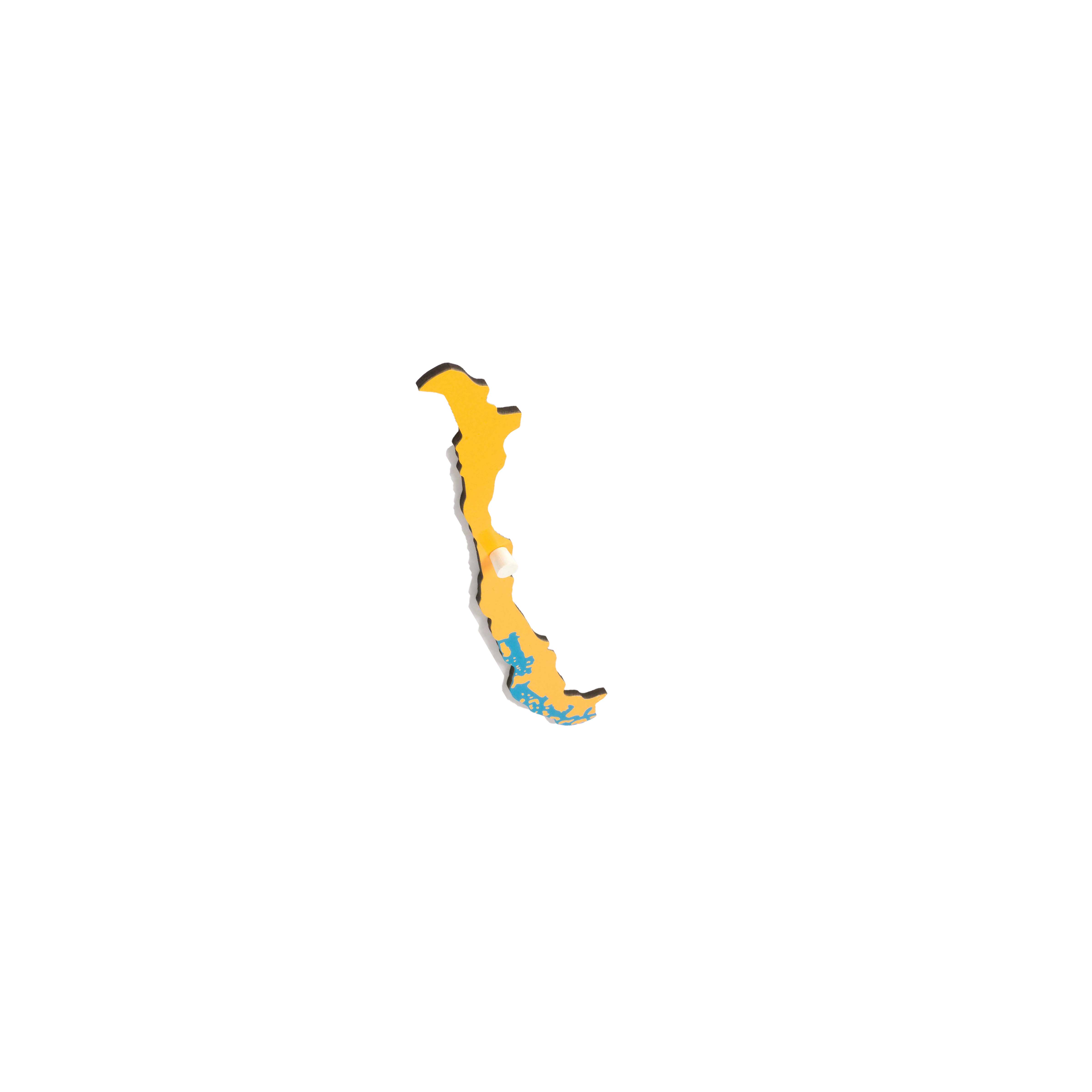
This individual Chile puzzle piece from the South America map introduces children to the distinctive elongated geography of this coastal nation. The painted surface clearly depicts Chile's diverse regions from the Atacama Desert to Patagonia, while the black border helps children recognize the country's unique shape and position along the Pacific coast.
“Education is a natural process spontaneously carried out by the human individual, and is acquired not by listening to words but by experiences upon the environment.”— Maria MontessoriEducation for a New World
“The child is both a hope and a promise for mankind.”
— Maria Montessori, Education and Peace
The Chile puzzle piece embodies Montessori's principle of isolation of difficulty by presenting one country's geography separate from the continental context. This painted wooden piece, with its distinctive elongated shape stretching along the Pacific coast, allows children to focus exclusively on Chile's unique geographical characteristics. The black border defining Chile's boundaries creates a clear visual impression that children can trace with their fingers, building muscle memory of this nation's remarkable 2,650-mile length. Through manipulating this individual puzzle piece, children develop an understanding of how Chile's narrow coastal position influences its diverse climates from desert to glacial regions. The painted surface depicting Chile's varied terrain from the Atacama Desert to Patagonia provides concrete sensorial information about how geography shapes a nation's identity. This single-country focus exemplifies how Montessori geography materials move from concrete to abstract, allowing children to build detailed knowledge of specific places before understanding their relationships within larger continental systems.
Each order includes everything needed for proper presentation and long-term use.
Follow the Montessori method of presentation for optimal child development.
Invite the child to carry the Chile piece to the mat using both hands
Trace the black border slowly with two fingers, starting from the northern point
Name the country clearly: 'This is Chile' while the child holds the piece
Guide observation of the painted regions from north to south
Demonstrate fitting the piece into the South America puzzle frame
Every material is carefully selected for durability, safety, and authentic Montessori experience.
The wooden base provides the durability needed for repeated handling while offering the natural texture that helps children connect geography to the physical world.
Each material supports multiple areas of child development simultaneously.
Children learn to identify Chile's distinctive shape and understand its position as South America's longest coastal nation.
The painted geographical features introduce concepts of diverse landscapes within a single country, from deserts to glaciers.
Handling the elongated puzzle piece develops understanding of scale and proportion in geographic representations.
The physical piece serves as a concrete introduction to Chilean culture and geography in the Montessori curriculum.
Designed for child-sized hands
Professional tips from AMI-trained guides to maximize the educational value of this material.
“Store the Chile piece separately from the complete map initially to allow focused work”
Create a basket with items from Chile (copper samples, alpaca wool) for cultural connections
Use the piece's extreme length to introduce superlatives in geography
Pair with sandpaper land and water forms to explain Chile's coastal geography
Everything you need to know about this material.
Chile's distinctive elongated shape stretching over 2,600 miles along South America's Pacific coast makes it instantly recognizable for children. The puzzle piece clearly shows diverse regions from the Atacama Desert in the north to Patagonia in the south, helping children understand how geography influences climate and culture.
This Chile piece fits perfectly into the complete South America puzzle map, allowing children to see Chile's relationships with neighboring countries Argentina, Bolivia, and Peru. When used alongside other country pieces, children develop a comprehensive understanding of South American geography and spatial relationships.
The painted surface depicts Chile's major geographical regions including the Atacama Desert, the Andes Mountains along the eastern border, the Central Valley, and the southern fjords of Patagonia. The black border clearly defines Chile's extensive Pacific coastline and narrow width.
Parents can discuss Chile's unique shape, explore why it's called the 'ribbon of land,' introduce Chilean culture through food or music, and use a globe to show Chile's position in the Southern Hemisphere. Children can trace the outline, color maps, or research Chilean animals like penguins and condors.
Children develop fine motor control through handling the piece, spatial awareness by fitting it into the larger map, visual discrimination in recognizing Chile's unique shape, and geography vocabulary. The material also builds cultural awareness and introduces concepts of borders, coastlines, and neighboring countries.
Can't find what you're looking for?
Contact Our Experts
Share your experience with this material and help other educators and parents.


