The Oceans Control Map: Unlabeled is a category.geography Montessori material designed for children aged 3-6, crafted by Nienhuis Montessori to AMI standards.
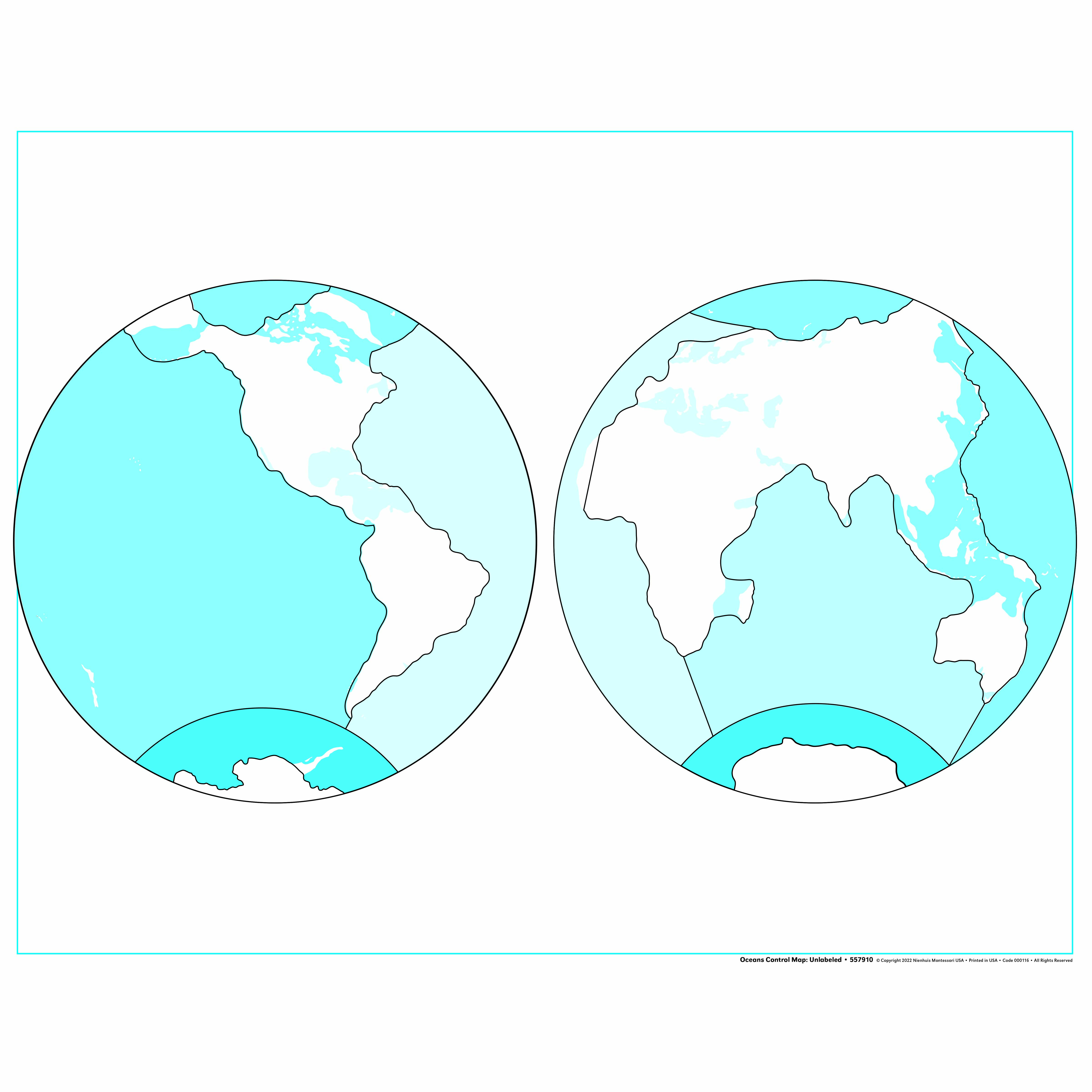
This unlabeled Oceans Control Map presents Earth's continents and oceans in a clear two-hemisphere projection, allowing children to explore global geography independently. The turquoise oceans and white landmasses create distinct visual boundaries, supporting the child's understanding of Earth's water and land distribution while developing spatial awareness and geographic vocabulary.
“Education is a natural process spontaneously carried out by the human individual, and is acquired not by listening to words but by experiences upon the environment.”— Maria MontessoriEducation for a New World
“The child is both a hope and a promise for mankind.”
— Maria Montessori, Education and Peace
The Oceans Control Map serves as a reference guide in Montessori geography work, providing children with a visual standard against which to verify their own work with puzzle maps and pin maps. This unlabeled control map specifically addresses the young child's need to understand Earth as a whole before diving into detailed study of individual continents. The turquoise oceans and white landmasses create a clear visual distinction that helps children aged 3-6 grasp the fundamental concept that Earth is covered primarily by water. In Montessori classrooms, control maps function as self-correcting tools, allowing children to check their work independently without adult intervention. The two-hemisphere projection on this Oceans Control Map mirrors the layout of corresponding Montessori puzzle maps, creating consistency in the child's geographic explorations. By presenting oceans without labels, this map encourages children to focus first on shape recognition and spatial relationships before adding the complexity of reading. The control map format respects the child's natural progression from concrete to abstract understanding, supporting their journey toward geographic literacy.
Each order includes everything needed for proper presentation and long-term use.
Follow the Montessori method of presentation for optimal child development.
Invite the child to trace the outline of each ocean with their finger, starting with the largest (Pacific)
Point to each ocean and share its name using clear, precise language
Play a finding game: 'Can you show me the Atlantic Ocean?'
Once familiar with ocean shapes, introduce the separate ocean labels for matching
Every material is carefully selected for durability, safety, and authentic Montessori experience.
Sourced from sustainably managed European forests. Beechwood is chosen for its exceptional durability, smooth grain, and natural warmth that invites touch.
Natural, unbleached cotton in child-friendly colors. The fabric provides the right amount of friction for developing fingers while being gentle on sensitive skin.
Water-based, child-safe finish that meets the strictest European safety standards. Designed to withstand years of daily use without chipping or peeling.
Each material supports multiple areas of child development simultaneously.
Children develop understanding of Earth's oceans and continents through visual discrimination and spatial relationships.
The high-contrast colors between water and land help children distinguish geographic boundaries and shapes.
Unlabeled format allows children to apply learned vocabulary and prepares them for more advanced geography work.
Children can work autonomously, checking their understanding of ocean and continent placement without adult guidance.
Designed for child-sized hands
Professional tips from AMI-trained guides to maximize the educational value of this material.
“Display the map at child height on a wall or low shelf for easy reference during other geography work”
Use this control map alongside the Montessori globe to help children understand the relationship between 3D and 2D representations
Create a map work station with this control map, puzzle maps, and pin maps for integrated geography exploration
Introduce ocean currents and marine life discussions once children master basic ocean identification
Everything you need to know about this material.
Unlabeled control maps have no text, allowing children to focus purely on shapes, colors, and spatial relationships. This encourages independent learning as children match the map with labeled materials or use nomenclature cards to identify oceans and continents themselves.
This map follows Montessori principles by isolating concepts (oceans vs. land), using distinct colors for visual discrimination, and allowing hands-on exploration. Children can trace boundaries, discuss water vs. land, and build concrete understanding before moving to abstract concepts.
Children can trace ocean boundaries, match with labeled maps, place ocean name labels, sort ocean/continent cards, create their own maps, discuss ocean characteristics, and explore which continents border which oceans. It also pairs well with ocean animal sorting activities.
The contrasting turquoise and white colors create clear visual boundaries that help young children distinguish water from land. This color coding is consistent across Montessori geography materials, supporting the child's ability to recognize and categorize Earth's features.
This map develops spatial awareness, visual discrimination, geographic vocabulary, fine motor skills through tracing, memory through repetition, and global awareness. It also supports language development as children learn ocean names and prepares them for more complex geography studies.
Can't find what you're looking for?
Contact Our Experts
Share your experience with this material and help other educators and parents.


