The North America: Waterways (50) is a category.geography Montessori material designed for children aged 3-6, crafted by Nienhuis Montessori to AMI standards.
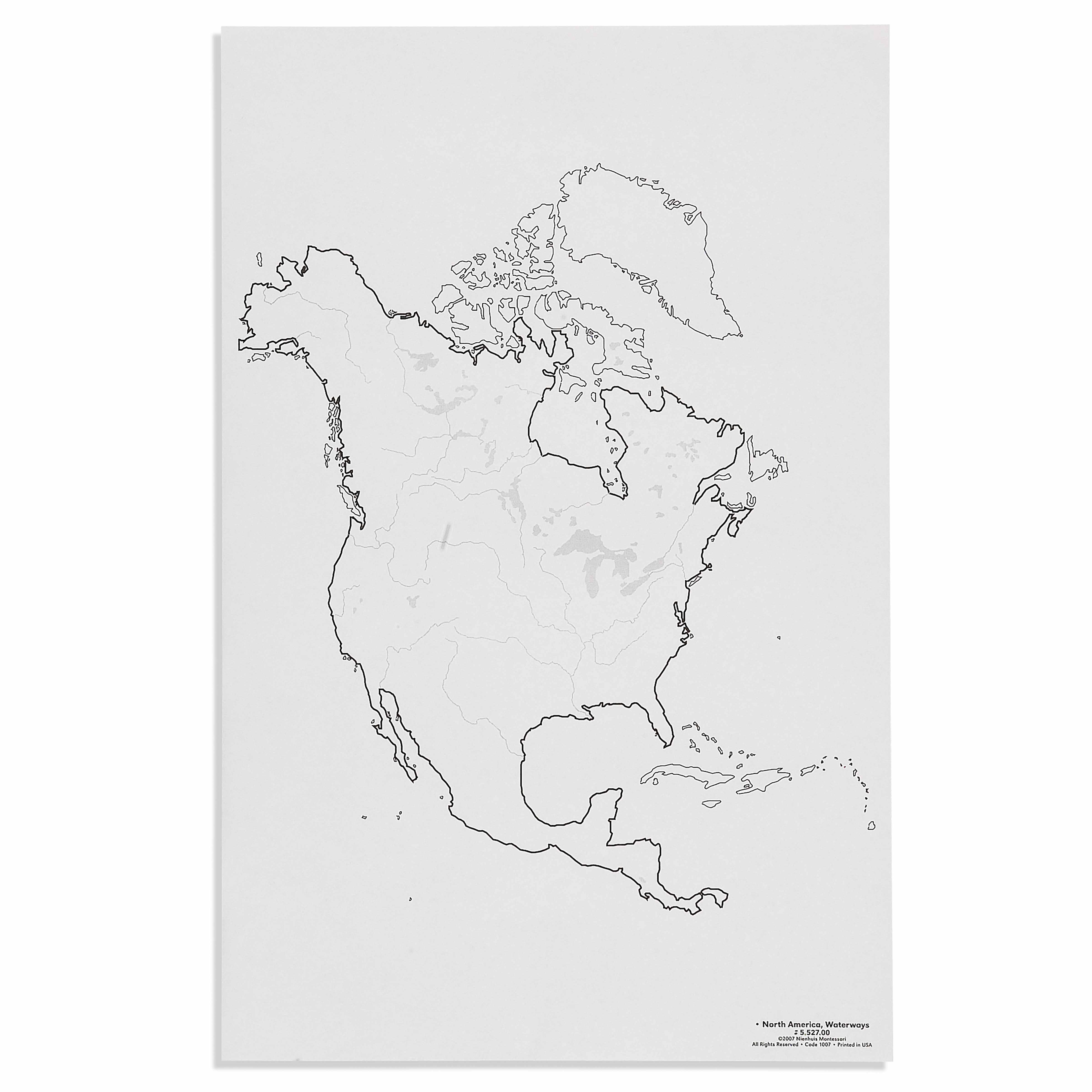
This detailed North American waterways map presents the continent's river systems, lakes, and coastal boundaries with clear geographical accuracy. Children explore the interconnected water networks from the Arctic archipelago through the Great Lakes to the Gulf of Mexico, building understanding of how water shapes continental geography and human settlement patterns.
“Education is a natural process spontaneously carried out by the human individual, and is acquired not by listening to words but by experiences upon the environment.”— Maria MontessoriEducation for a New World
“The child is both a hope and a promise for mankind.”
— Maria Montessori, Education and Peace
The North America: Waterways map fulfills the young child's need to understand their place within the larger world through concrete, visual representations. This waterways map allows children to trace river systems with their fingers, discovering how water connects distant regions from the Arctic archipelago to the Gulf of Mexico. In Montessori geography, the study of waterways comes after children have grasped land and water forms through sandpaper globes and puzzle maps, as waterways represent more complex geographical relationships. The map's clear boundaries and accurate continental water networks satisfy the child's desire for order while presenting real geographical knowledge. By exploring North America's interconnected water systems, children develop an understanding of how rivers, lakes, and oceans shape human civilization and natural environments. This material bridges the sensorial exploration of water through pouring exercises with the abstract concept of continental water systems, making geography tangible and meaningful.
Each order includes everything needed for proper presentation and long-term use.
Follow the Montessori method of presentation for optimal child development.
Invite the child to explore the map, starting at the Arctic Ocean and moving fingers along the coastline
Choose one major river system like the Mississippi and trace its entire path from source to mouth
Compare river lengths by tracing different waterways with your finger
Identify all five Great Lakes, noting how they connect to each other and to the ocean
Find your local waterway on the map and trace where its water eventually flows
Every material is carefully selected for durability, safety, and authentic Montessori experience.
Sourced from sustainably managed European forests. Beechwood is chosen for its exceptional durability, smooth grain, and natural warmth that invites touch.
Natural, unbleached cotton in child-friendly colors. The fabric provides the right amount of friction for developing fingers while being gentle on sensitive skin.
Water-based, child-safe finish that meets the strictest European safety standards. Designed to withstand years of daily use without chipping or peeling.
Each material supports multiple areas of child development simultaneously.
Builds spatial awareness of North American water systems and their relationship to political boundaries and human settlement.
Helps children understand how rivers, lakes, and oceans connect different regions and influence climate and ecology.
Develops ability to trace water pathways and distinguish between different types of water bodies and land features.
Introduces concepts of how waterways influence trade, transportation, and the development of cities and civilizations.
Designed for child-sized hands
Professional tips from AMI-trained guides to maximize the educational value of this material.
“Present this material after children have worked extensively with land and water form trays and the puzzle map of North America”
Keep a pitcher of water nearby to demonstrate how water always flows downward, connecting to river flow patterns on the map
Create matching cards with river names and their locations to reinforce geographical vocabulary
Use this map during cultural studies when discussing how civilizations develop near water sources
Everything you need to know about this material.
The map features major river systems including the Mississippi, Missouri, Colorado, and St. Lawrence rivers, the Great Lakes system, Arctic waterways, coastal boundaries along the Atlantic, Pacific, and Gulf of Mexico, plus significant lakes and water networks throughout Canada, the United States, and Mexico.
Young children can trace rivers with their fingers, identify and name major water bodies, match water feature cards to locations, color different waterways, and explore how rivers flow from mountains to oceans. The visual presentation helps them understand water's role in geography through hands-on exploration.
This map develops understanding of water cycles, directional concepts (rivers flow downhill), geographical vocabulary (river, lake, ocean, gulf), spatial relationships between water and land, how water shapes landscapes, and the importance of waterways for transportation and settlement patterns.
Enhance learning with water cycle experiments, blue ribbons or yarn to trace river paths, water feature nomenclature cards, photos of famous waterways, simple boats for discussing water transportation, and books about rivers and lakes. Consider pairing with landform materials for complete geographical understanding.
The map uses clear, simplified lines to show water systems while maintaining geographical accuracy. Major waterways are prominently featured with age-appropriate detail levels. The visual design emphasizes the interconnected nature of water systems without overwhelming young children with excessive detail.
Can't find what you're looking for?
Contact Our Experts
Share your experience with this material and help other educators and parents.


