The North America: Political (50) is a category.geography Montessori material designed for children aged 3-6, crafted by Nienhuis Montessori to AMI standards.
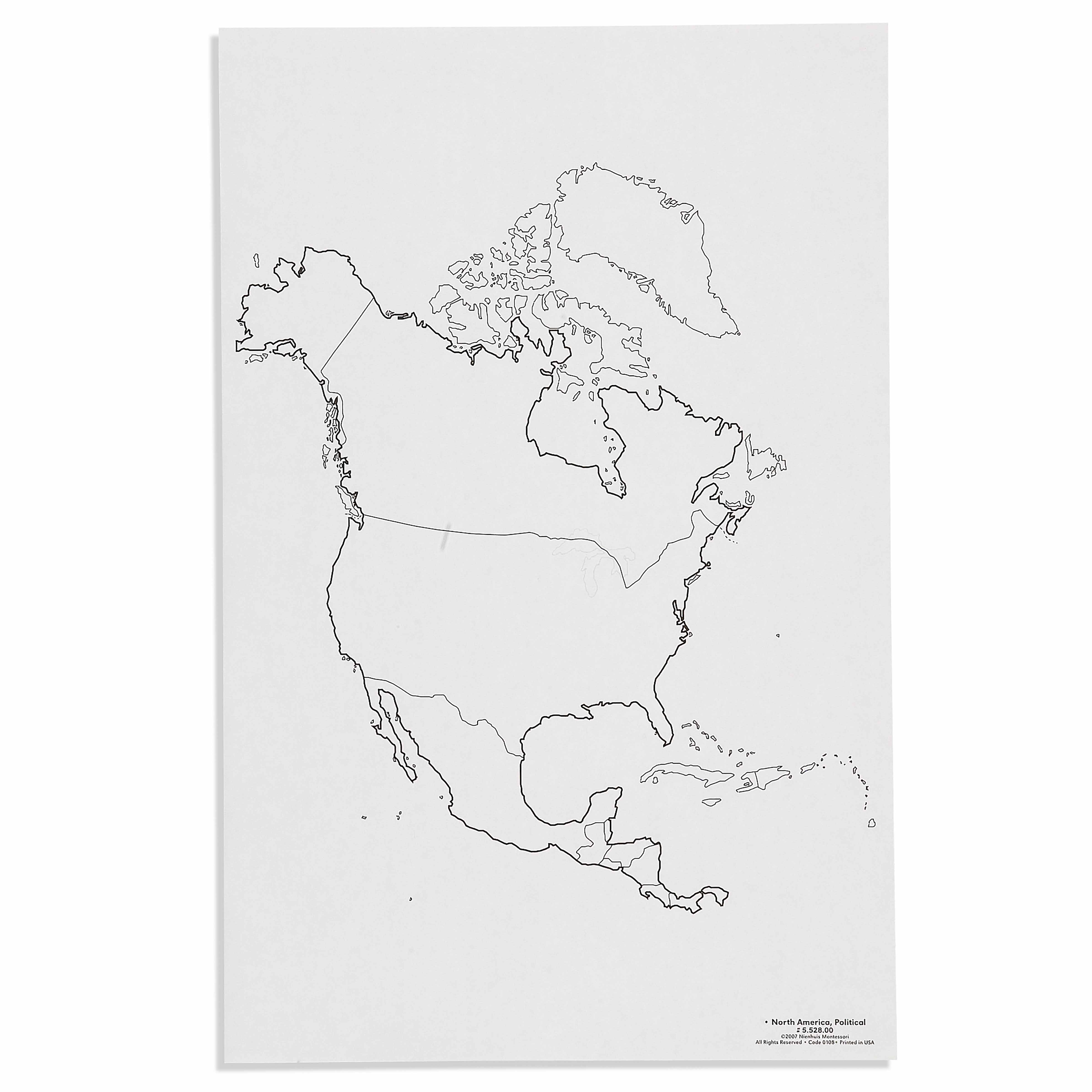
This political map of North America introduces children to the continent's country boundaries and geographical relationships. The clear outline format with minimal labeling allows young learners to explore political divisions independently, supporting the Montessori approach to concrete geography learning through visual recognition and spatial understanding.
“Education is a natural process spontaneously carried out by the human individual, and is acquired not by listening to words but by experiences upon the environment.”— Maria MontessoriEducation for a New World
“The child is both a hope and a promise for mankind.”
— Maria Montessori, Education and Peace
The North America Political Map serves as a visual bridge between the child's sensorial experiences and abstract geographical concepts. This map poster presents country boundaries as distinct visual elements, allowing children to perceive political divisions through color and line recognition before formal naming begins. In Montessori geography, political maps introduce human-created boundaries after children understand natural formations, reflecting how societies organize within physical landscapes. The poster's clear outline format respects the child's need for isolated concepts - presenting only essential boundaries without overwhelming detail. By displaying North America's political divisions at child-eye level, this map transforms abstract national concepts into concrete visual experiences. The minimal labeling on this political map honors the Montessori principle of presenting one difficulty at a time, allowing children to first internalize shapes and spatial relationships before adding nomenclature. This poster becomes a reference point for cultural studies, helping children understand that people live in organized communities called countries.
Each order includes everything needed for proper presentation and long-term use.
Follow the Montessori method of presentation for optimal child development.
Invite the child to observe the map, tracing the outline of North America with their finger
Point to and trace individual country boundaries, starting with the largest (Canada, USA, Mexico)
Introduce country names using three-period lesson format with prepared labels
Play matching games with country shapes cut from colored paper to the map
Every material is carefully selected for durability, safety, and authentic Montessori experience.
Sourced from sustainably managed European forests. Beechwood is chosen for its exceptional durability, smooth grain, and natural warmth that invites touch.
Natural, unbleached cotton in child-friendly colors. The fabric provides the right amount of friction for developing fingers while being gentle on sensitive skin.
Water-based, child-safe finish that meets the strictest European safety standards. Designed to withstand years of daily use without chipping or peeling.
Each material supports multiple areas of child development simultaneously.
Develops understanding of political boundaries and spatial relationships between countries in North America.
Strengthens ability to distinguish shapes and boundaries through clear outline format.
Introduces concepts of countries and territories, building foundation for cultural geography studies.
Encourages focused observation and careful study of map details during independent work.
Designed for child-sized hands
Professional tips from AMI-trained guides to maximize the educational value of this material.
“Present this political map after children have worked with the physical features map of North America”
Create complementary materials like country outline cards that children can trace and color
Use the map during circle time to mark special events happening in different countries
Connect map work to practical life by locating where classroom materials or foods originate
Everything you need to know about this material.
This map is specifically designed for children ages 3-6, with clear, simple boundaries that young learners can easily distinguish and trace, making it perfect for early geography exploration in Montessori environments.
This political map shows country boundaries and borders within North America, while a physical map would display natural features like mountains, rivers, and terrain. The political map helps children understand how humans have divided the continent into nations.
The map includes all North American countries: Canada, United States, Mexico, and the Central American nations (Guatemala, Belize, El Salvador, Honduras, Nicaragua, Costa Rica, Panama), as well as Caribbean island nations.
Children can trace country outlines, match country puzzle pieces to the map, color different nations, place flags or labels, and use it as a control chart for other North America materials. It supports concrete learning through visual and tactile exploration.
While specific dimensions aren't listed, Montessori geography maps are typically printed on durable cardstock or laminated paper suitable for repeated handling by young children, sized appropriately for table work or wall display in the classroom.
Can't find what you're looking for?
Contact Our Experts
Share your experience with this material and help other educators and parents.


