The Land Form Cards is a category.geography Montessori material designed for children aged 3-6, crafted by Nienhuis Montessori to AMI standards.
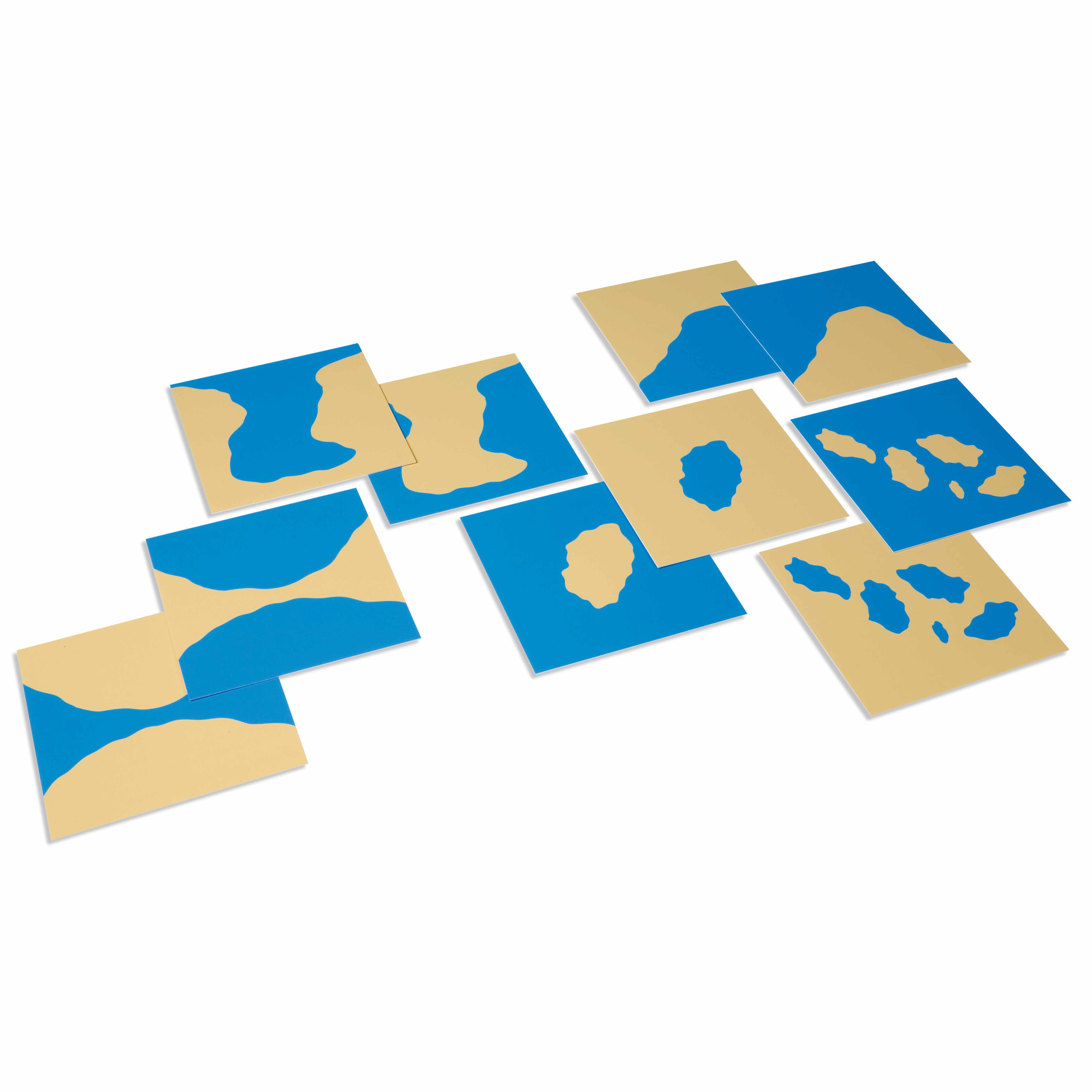
These Land Form Cards introduce children to fundamental geographic concepts through visual matching activities. Each card features clear representations of land and water forms like islands, lakes, and peninsulas, helping children understand how land and water interact in nature. The contrasting colors and simple designs make abstract geographic concepts concrete and accessible for young learners.
“Education is a natural process spontaneously carried out by the human individual, and is acquired not by listening to words but by experiences upon the environment.”— Maria MontessoriEducation for a New World
“The child is both a hope and a promise for mankind.”
— Maria Montessori, Education and Peace
Land Form Cards transform abstract geographic concepts into tangible visual experiences for the young child. These geography learning cards present islands, lakes, and peninsulas through clear, contrasting images that isolate each land and water formation. The cards' simple designs allow children to perceive geographic relationships without overwhelming detail, matching the absorbent mind's need for clarity and order. Each card becomes a concrete representation of Earth's surface features, enabling the child to build mental maps of how land and water interact. The visual matching activities inherent in Land Form Cards satisfy the three-to-six-year-old's drive to classify and categorize their world. Through repeated work with these cards, children internalize fundamental geographic vocabulary and concepts, preparing them for more complex geographic studies. The cards' clear representations serve as a bridge between the child's immediate environment and the wider world, fostering geographic awareness through concrete visual impressions.
Each order includes everything needed for proper presentation and long-term use.
Follow the Montessori method of presentation for optimal child development.
Present three land form cards (e.g., island, lake, peninsula) and name each one clearly
Invite the child to match identical cards, placing pairs together
Introduce the three-period lesson: 'This is an island,' 'Show me the peninsula,' 'What is this?'
Once familiar with several forms, invite the child to sort cards by characteristic (surrounded by water, contains water, etc.)
Every material is carefully selected for durability, safety, and authentic Montessori experience.
Heavy-duty cardstock ensures these learning materials withstand repeated handling by young children while maintaining crisp, clear images.
Each material supports multiple areas of child development simultaneously.
Children develop understanding of how land and water forms shape our world through concrete visual representations.
Matching activities strengthen observation skills and ability to identify subtle differences in shapes.
Introduces specific geographic terminology like 'peninsula' and 'archipelago' at the appropriate developmental stage.
Transitions children from concrete objects to symbolic representations, preparing for map work.
Designed for child-sized hands
Professional tips from AMI-trained guides to maximize the educational value of this material.
“Present land forms in logical pairs (island/lake, peninsula/gulf) to highlight complementary relationships”
Connect card work to globes and maps in the environment, showing real examples of presented forms
Allow children to trace card outlines onto paper, creating their own land form booklets
Use consistent geographic terminology across all presentations to build precise vocabulary
Everything you need to know about this material.
The set typically includes fundamental land and water forms such as island, lake, peninsula, gulf, strait, isthmus, archipelago, bay, cape, and system of lakes. Each form is presented with clear visual representations using contrasting colors for land and water.
Children match identical cards, learn vocabulary through three-period lessons, and can create their own land forms with clay or sand and water. The cards serve as control cards for self-correction when working with 3D land form models or trays.
These cards develop geographic vocabulary, visual discrimination, understanding of spatial relationships between land and water, classification skills, and preparation for more advanced geography studies. They also enhance language development and scientific thinking.
Yes, the cards are designed for ages 3-6 and feature clear visual representations that don't require reading skills. The contrasting colors and simple designs allow young children to understand geographic concepts through visual learning and matching activities.
Land form cards complement 3D land form models, sandpaper globe, colored globe, and puzzle maps. They provide the vocabulary foundation for understanding geographic features children will encounter in more advanced geography work and outdoor explorations.
Can't find what you're looking for?
Contact Our Experts
Share your experience with this material and help other educators and parents.


