The Land And Water Form Trays: Set 2 is a category.geography Montessori material designed for children aged 3-6, crafted by Nienhuis Montessori to AMI standards.
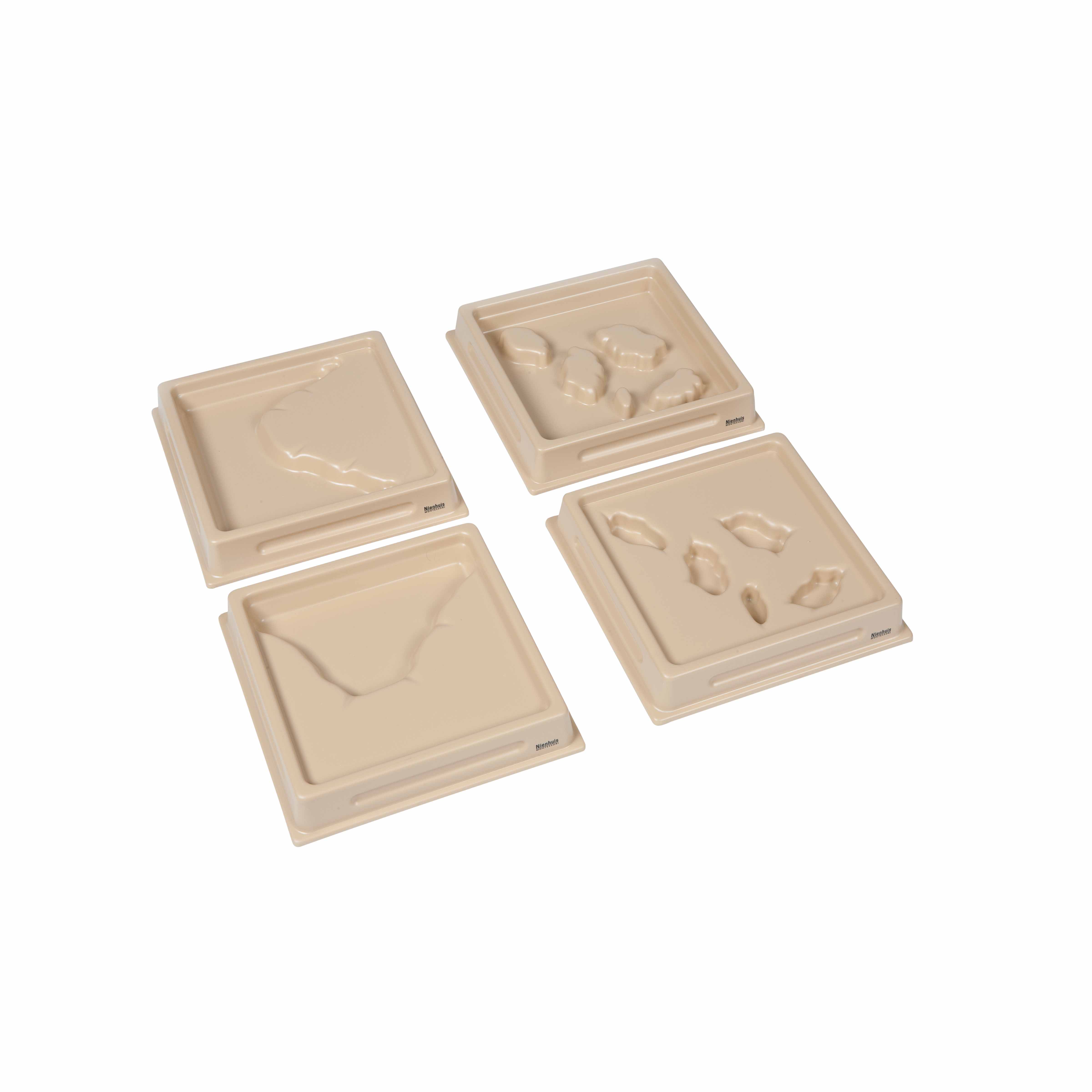
This Set 2 of Land and Water Form Trays introduces children to intermediate geographical features through tactile exploration. The durable polymer trays feature embossed formations including strait, isthmus, system of lakes, and archipelago, allowing children to trace and fill the recessed areas with water to understand how land and water interact in nature.
“Education is a natural process spontaneously carried out by the human individual, and is acquired not by listening to words but by experiences upon the environment.”— Maria MontessoriEducation for a New World
“The child is both a hope and a promise for mankind.”
— Maria Montessori, Education and Peace
Land and Water Form Trays Set 2 addresses the young child's need to understand complex geographical relationships through sensorial exploration. These polymer trays with their embossed formations of strait, isthmus, system of lakes, and archipelago provide concrete experiences of abstract concepts. When children trace the raised edges and pour water into the recessed areas, they discover how narrow waterways connect larger bodies (strait) and how thin strips of land join continents (isthmus). The tactile nature of these trays allows children to feel the boundaries between land and water, making geographical vocabulary meaningful through direct manipulation. This hands-on approach with the Land and Water Form Trays transforms abstract map concepts into tangible experiences, preparing children for later work with puzzle maps and atlases. The act of carefully pouring water into each formation develops concentration while building a sensorial foundation for understanding Earth's diverse landscapes.
Each order includes everything needed for proper presentation and long-term use.
Follow the Montessori method of presentation for optimal child development.
Invite the child to trace the raised edges of the strait formation with their index finger
Pour water carefully into the strait's recessed area, filling to the rim
Discuss how the strait connects two larger bodies of water while the child observes
Empty the tray using the sponge, then proceed to the isthmus
Continue with system of lakes and archipelago, allowing exploration time for each
Each material supports multiple areas of child development simultaneously.
Children learn precise terminology for complex land and water formations through hands-on manipulation.
Tracing and filling formations develops understanding of positive and negative space relationships.
Experimenting with water flow between formations introduces basic concepts of geography and hydrology.
Carefully pouring water and tracing formations refines hand movements and coordination.
Designed for child-sized hands
Professional tips from AMI-trained guides to maximize the educational value of this material.
“Present formations in contrasting pairs (strait/isthmus) to highlight differences between water passages and land bridges”
Keep language precise - use 'strait' not 'narrow water' to build accurate vocabulary
Allow children to repeat water-filling multiple times to satisfy their need for repetition
Strait of Gibraltar, Isthmus of Panama
Everything you need to know about this material.
Set 2 includes four intermediate land and water forms: strait (narrow water passage between two land masses), isthmus (narrow land bridge connecting two larger land areas), system of lakes (multiple connected lakes), and archipelago (group of islands). These build upon the basic forms learned in Set 1.
Children pour water into the recessed areas of each tray to visually demonstrate how water and land interact. The embossed formations clearly show boundaries, and the water fills the appropriate areas to create a realistic representation of each geographical feature. Use a pitcher and food coloring for enhanced visibility.
The trays are made from high-quality, durable polymer that is water-resistant and designed for repeated classroom use. The material is sturdy enough to withstand daily handling by young children while maintaining clear, defined embossed formations that won't wear down over time.
While Set 2 can be used independently, it's recommended to introduce Set 1 first as it contains basic land and water forms (island, lake, peninsula, gulf, cape, bay). Set 2 presents more complex formations that are easier to understand once children have mastered the fundamental concepts from Set 1.
Extensions include: creating matching nomenclature cards, finding real-world examples on maps or globes, making clay models of the forms, drawing the formations, creating definitions booklets, and comparing how these features appear in different parts of the world. Children can also use blue and brown paper to create 2D representations.
Can't find what you're looking for?
Contact Our Experts
Share your experience with this material and help other educators and parents.

