The Europe: Political (50) is a category.geography Montessori material designed for children aged 3-6, crafted by Nienhuis Montessori to AMI standards.
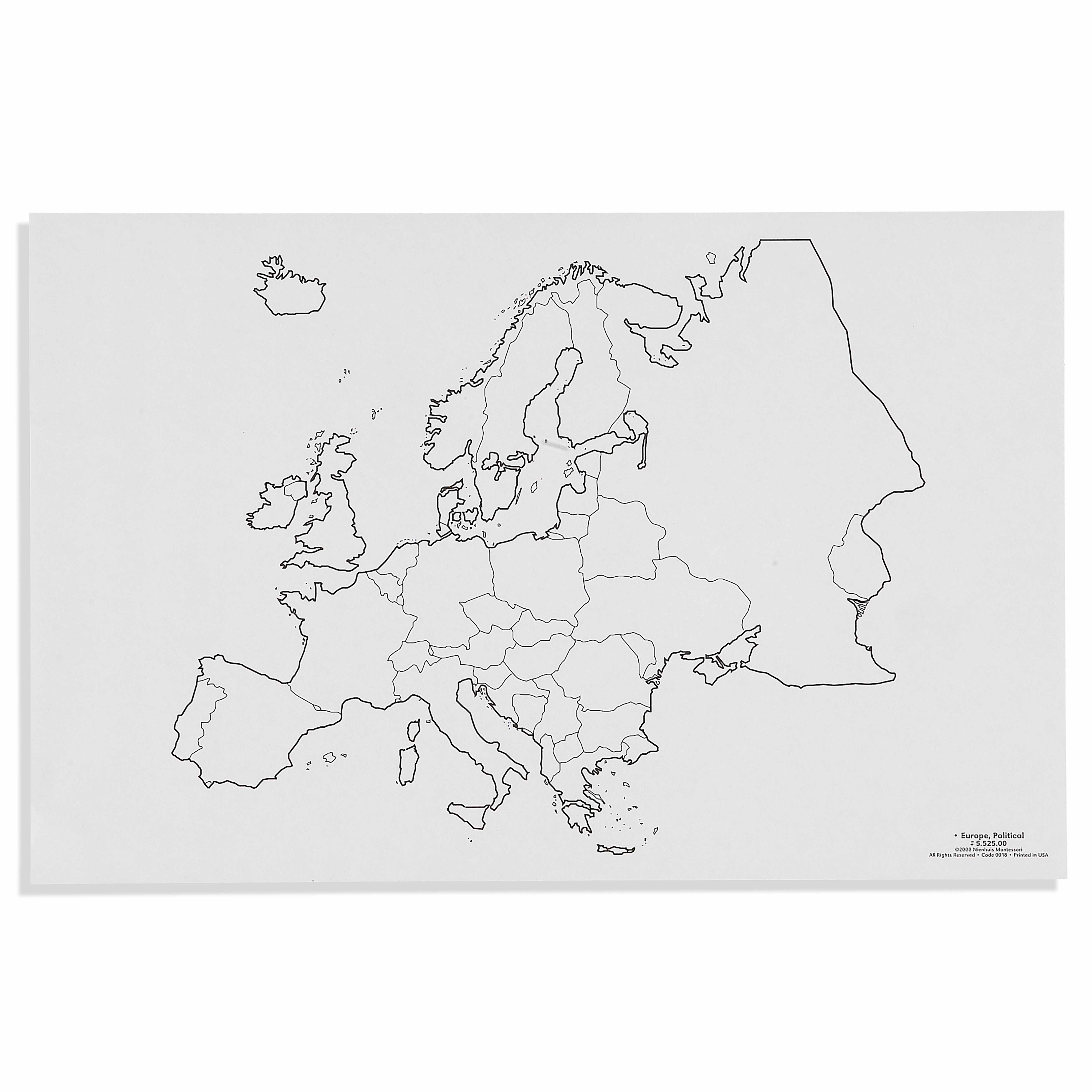
This political map of Europe presents a clear outline of national boundaries and coastal features, designed for children to explore European geography through hands-on activities. The blank, unlabeled format allows young learners to place country labels, trace borders, or color regions while developing their understanding of political geography and spatial relationships.
“Education is a natural process spontaneously carried out by the human individual, and is acquired not by listening to words but by experiences upon the environment.”— Maria MontessoriEducation for a New World
“The child is both a hope and a promise for mankind.”
— Maria Montessori, Education and Peace
The Europe Political Map creates a bridge between the child's concrete sensorial explorations and their emerging understanding of abstract concepts like nations and borders. By presenting Europe's political boundaries as a blank canvas, this map respects the child's need to construct knowledge through active manipulation rather than passive reception. The unlabeled format of this political map honors the Montessori principle that children learn through discovery - each border traced, each country colored becomes a personal revelation rather than memorized information. This map's clear coastal outlines and national boundaries provide the exact level of detail needed for young children to grasp that Europe consists of distinct nations while avoiding overwhelming complexity. Through working with this political map, children develop their spatial intelligence by physically engaging with Europe's geography, building mental maps that will serve as foundations for later cultural and historical understanding.
Each order includes everything needed for proper presentation and long-term use.
Follow the Montessori method of presentation for optimal child development.
Invite the child to trace the outline of Europe with their finger, noting how water surrounds much of the continent
Choose one country to trace with a colored pencil, following its borders carefully
Color the traced country, staying within the borders
If using labels, match country names to their locations on the map
Repeat with additional countries as interest continues
Every material is carefully selected for durability, safety, and authentic Montessori experience.
Sourced from sustainably managed European forests. Beechwood is chosen for its exceptional durability, smooth grain, and natural warmth that invites touch.
Natural, unbleached cotton in child-friendly colors. The fabric provides the right amount of friction for developing fingers while being gentle on sensitive skin.
Water-based, child-safe finish that meets the strictest European safety standards. Designed to withstand years of daily use without chipping or peeling.
Each material supports multiple areas of child development simultaneously.
Children develop understanding of European countries, their shapes, sizes, and relative positions through hands-on exploration.
Tracing borders and placing labels refines pencil control and hand-eye coordination essential for writing preparation.
Introduces concepts of nations and boundaries, laying groundwork for cultural studies and global awareness.
Recognizing and differentiating between country shapes and sizes enhances visual perception and spatial intelligence.
Designed for child-sized hands
Professional tips from AMI-trained guides to maximize the educational value of this material.
“Keep a completed reference map nearby but not directly visible during the child's work”
Prepare sets of country labels in both cursive and print for different reading levels
Connect map work to cultural activities like food preparation or folk tales from specific countries
Use the map for group activities where children share something they know about different countries
Everything you need to know about this material.
This map is specifically designed for children ages 3-6 years old, with simple, clear boundaries that are appropriate for early learners beginning to explore geography.
The map comes in a blank, unlabeled format, allowing children to add their own labels, trace borders, or color different countries as part of their learning activities.
Children can use this map for various activities including placing country label cards, tracing national borders, coloring different regions, and learning to identify European countries through hands-on exploration.
While specific dimensions aren't listed, Montessori maps are typically made of durable materials suitable for repeated handling by young children. Please contact us for exact specifications.
This map follows Montessori principles by providing a concrete, hands-on material that allows children to explore abstract concepts of political boundaries through sensorial experiences like tracing, coloring, and labeling.
Can't find what you're looking for?
Contact Our Experts
Share your experience with this material and help other educators and parents.


