The Australia: Waterways (50) is a category.geography Montessori material designed for children aged 3-6, crafted by Nienhuis Montessori to AMI standards.
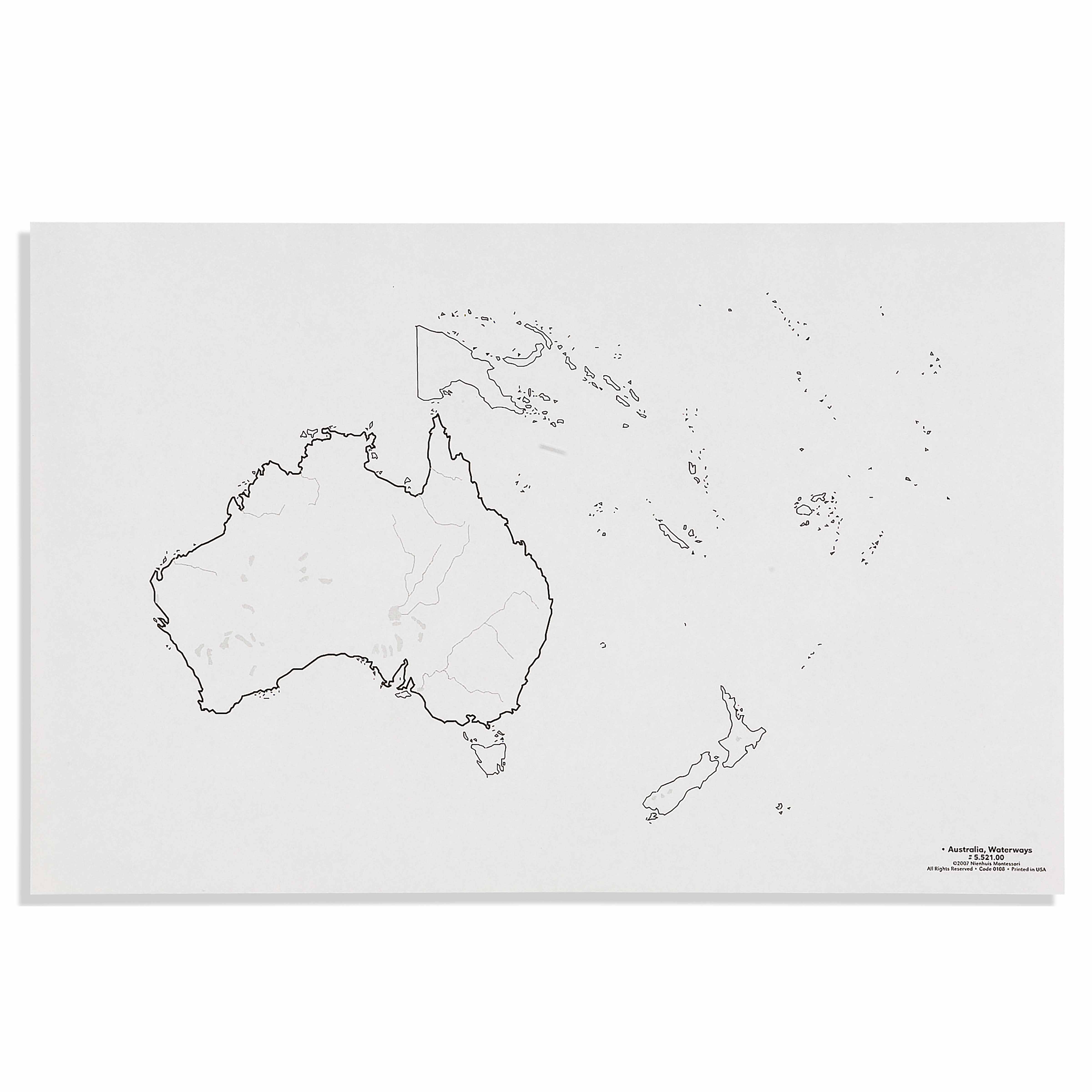
This detailed waterways map introduces children to Australia's major rivers and water systems through hands-on exploration. The puzzle format encourages children to trace river paths while developing geographic understanding of how waterways shape the continent and connect different regions.
“Education is a natural process spontaneously carried out by the human individual, and is acquired not by listening to words but by experiences upon the environment.”— Maria MontessoriEducation for a New World
“The child is both a hope and a promise for mankind.”
— Maria Montessori, Education and Peace
The Australia Waterways puzzle addresses the child's need to understand how water shapes our physical world. By tracing the Murray-Darling system with their fingers, children discover how rivers create pathways across continents. Each waterway piece fits precisely into the puzzle frame, allowing children to build Australia's water network through repeated manipulation. This 50-piece construction reveals how the Great Artesian Basin connects to coastal rivers, making abstract hydrological concepts concrete through touch. The puzzle's river paths guide small hands along actual water routes, transforming geographic study into sensorial exploration. When children place each waterway piece, they internalize how rivers flow from highlands to oceans, understanding Australia's water systems through their own purposeful movement.
Each order includes everything needed for proper presentation and long-term use.
Follow the Montessori method of presentation for optimal child development.
Start with the longest river piece (Murray River) and trace its path with your finger
Add tributary pieces one at a time, naming each waterway
Complete one river system before moving to another region
Trace completed waterways from source to sea with a finger
Every material is carefully selected for durability, safety, and authentic Montessori experience.
The sturdy wooden foundation provides durability for repeated use while offering the natural texture children prefer in Montessori materials.
Each material supports multiple areas of child development simultaneously.
Children develop understanding of how rivers and waterways connect different regions of Australia.
Tracing river paths builds spatial intelligence and understanding of natural patterns.
Introduces the relationship between waterways and human settlement patterns.
Handling puzzle pieces and tracing waterways refines hand movements and coordination.
Designed for child-sized hands
Professional tips from AMI-trained guides to maximize the educational value of this material.
“Present this after children master the basic Australia puzzle map”
Keep a water pitcher nearby to demonstrate how water flows downhill
Create matching cards showing photographs of actual Australian rivers
Use blue yarn to extend river paths beyond the puzzle onto floor maps
Everything you need to know about this material.
This puzzle includes Australia's major rivers such as the Murray-Darling system, Cooper Creek, Diamantina River, and other significant waterways. Children can trace each river's path from source to sea, learning how these water systems connect different regions of the continent.
The hands-on puzzle format allows children to physically trace river paths with their fingers, providing sensory learning experiences. This concrete manipulation helps young learners understand abstract concepts like water flow, continental drainage, and how waterways shape landscapes and communities.
Children develop geographic awareness, fine motor control through puzzle manipulation, spatial reasoning by following river paths, and early environmental understanding. They also build vocabulary related to water systems and begin to comprehend how waterways influence human settlement and ecosystems.
Made with high-quality materials suitable for repeated handling by young children, this puzzle features smooth edges and sturdy pieces. The waterways are clearly marked with appropriate contrast for easy identification, and the materials are designed to withstand daily classroom use.
Yes, this waterways map complements other Australian geography materials, landform models, and cultural studies. Teachers can create extensions by discussing water conservation, indigenous connections to waterways, or comparing Australian rivers with waterways from other continents in your geography collection.
Can't find what you're looking for?
Contact Our Experts
Share your experience with this material and help other educators and parents.


