The Asia: Outline (50) is a category.geography Montessori material designed for children aged 3-6, crafted by Nienhuis Montessori to AMI standards.
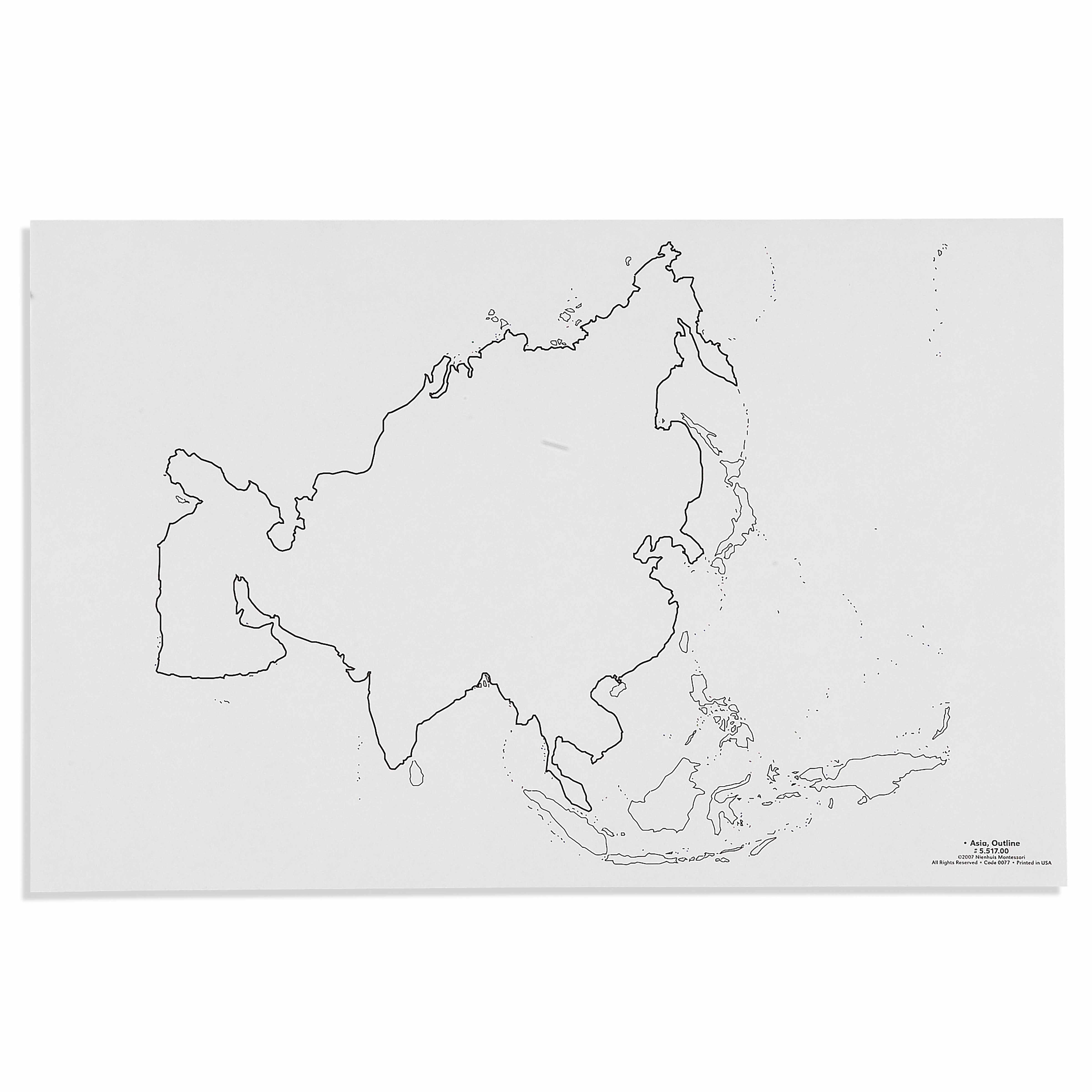
This laminated outline map presents the continent of Asia with clearly defined country boundaries and surrounding island chains. The control map serves as a reference guide for children working with the Asia puzzle map, supporting their understanding of political boundaries and geographical relationships. The durable laminated construction allows for repeated handling as children trace countries and explore the diverse regions of the world's largest continent.
“Education is a natural process spontaneously carried out by the human individual, and is acquired not by listening to words but by experiences upon the environment.”— Maria MontessoriEducation for a New World
“The child is both a hope and a promise for mankind.”
— Maria Montessori, Education and Peace
The Asia Outline map introduces young children to the world's largest continent through a laminated reference tool that complements hands-on puzzle work. In Montessori geography, outline maps serve as the bridge between concrete manipulation and abstract understanding, allowing children to verify their puzzle placements against accurate political boundaries. The laminated surface of this Asia map invites repeated tracing and exploration, meeting the child's need to understand their place in the wider world. By presenting Asia's complex geography—from Russia's vast expanse to Indonesia's archipelago—this outline map respects children's capacity to grasp sophisticated geographical concepts. The clear country boundaries on the laminated sheet provide the visual clarity essential for the absorbent mind, while the durability ensures countless children can explore Asia's 48 countries. This control map transforms abstract political divisions into tangible learning experiences through the simple act of matching puzzle pieces to outlined shapes.
Each order includes everything needed for proper presentation and long-term use.
Follow the Montessori method of presentation for optimal child development.
Invite the child to remove all pieces from the Asia puzzle map
Select one puzzle piece and find its corresponding outline on the control map
Place the puzzle piece on the outline map to verify the match
Return the piece to the puzzle frame in its correct location
Continue matching pieces to outlines until the puzzle is complete
Every material is carefully selected for durability, safety, and authentic Montessori experience.
Sourced from sustainably managed European forests. Beechwood is chosen for its exceptional durability, smooth grain, and natural warmth that invites touch.
Natural, unbleached cotton in child-friendly colors. The fabric provides the right amount of friction for developing fingers while being gentle on sensitive skin.
Water-based, child-safe finish that meets the strictest European safety standards. Designed to withstand years of daily use without chipping or peeling.
Each material supports multiple areas of child development simultaneously.
Develops awareness of Asia's political boundaries and the relationships between countries and regions.
Strengthens ability to distinguish between different country shapes and recognize geographical features.
Introduces fundamental cartographic concepts through clear visual representation of boundaries.
Provides foundation for discussions about Asian countries, peoples, and cultures.
Designed for child-sized hands
Professional tips from AMI-trained guides to maximize the educational value of this material.
“Store the laminated map flat in a geography folder to prevent curling at edges”
Demonstrate how to handle the map with two hands to avoid creasing
Pair this outline map with cultural objects from various Asian countries
Use the map during circle time to mark countries when discussing cultural celebrations
Everything you need to know about this material.
This product includes a laminated outline map of Asia showing all country boundaries, surrounding island chains, and political divisions. It serves as a control map to accompany the Asia puzzle map for geography studies.
Children use this map as a reference guide when working with the Asia puzzle map. They can trace countries, identify boundaries, match puzzle pieces to the outline, and learn the names and locations of Asian countries through hands-on exploration.
Yes, the map is laminated for durability, making it suitable for repeated handling by young children. The lamination protects the map from wear, spills, and frequent use in both classroom and home environments.
This map is specifically designed for children ages 3-6 years, aligning with the Montessori primary curriculum for geography studies and early cultural education.
This is a political outline map focusing on country boundaries and borders. It shows the political divisions of Asian countries and their surrounding islands, but does not include physical features like mountains or rivers.
Can't find what you're looking for?
Contact Our Experts
Share your experience with this material and help other educators and parents.


