The Africa: Outline (50) is a category.geography Montessori material designed for children aged 3-6, crafted by Nienhuis Montessori to AMI standards.
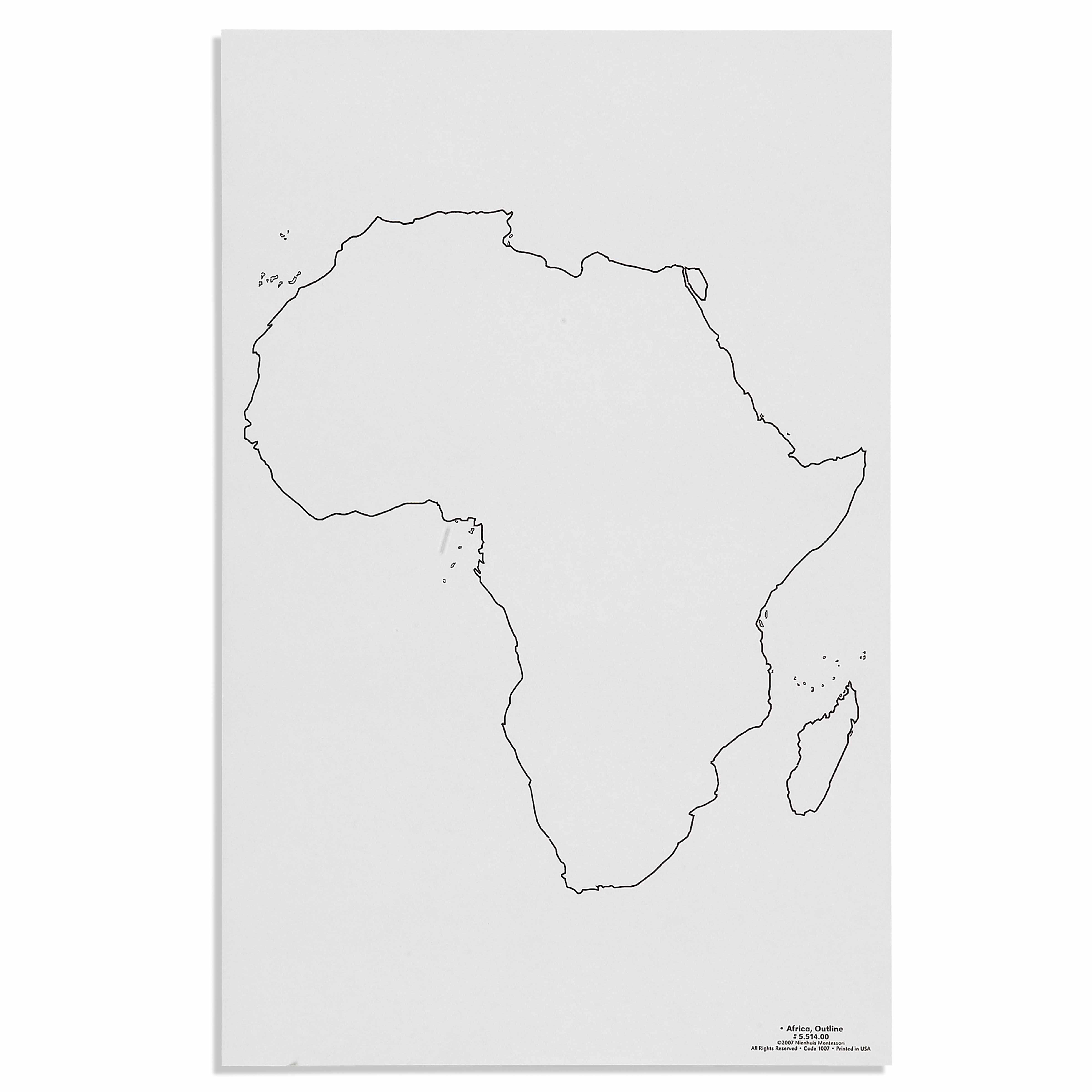
This Africa outline map provides a clear, minimalist representation of the continent for geography activities in the Montessori classroom. The precise black outline on white background allows children to trace, color, and explore the shape of Africa while developing their understanding of continental geography and spatial relationships.
“Education is a natural process spontaneously carried out by the human individual, and is acquired not by listening to words but by experiences upon the environment.”— Maria MontessoriEducation for a New World
“The child is both a hope and a promise for mankind.”
— Maria Montessori, Education and Peace
The Africa outline map introduces children to continental geography through a precise black outline on white background that isolates the distinctive shape of Africa. This minimalist design allows the child to focus entirely on the continent's form without distracting details, supporting the Montessori principle of isolation of concept. The outline map serves as a control map for pin-punching, tracing, and coloring activities that develop both geographical awareness and fine motor skills. By working with this clear Africa outline repeatedly, children internalize the continent's unique shape through their hands before their intellect fully grasps its significance. The map's simple presentation respects the child's need to build knowledge from concrete to abstract, starting with the sensorial experience of tracing Africa's borders. This outline becomes a foundation for later work with political maps, physical features, and cultural studies, establishing Africa as a meaningful geographical entity in the child's developing world view.
Each order includes everything needed for proper presentation and long-term use.
Follow the Montessori method of presentation for optimal child development.
Invite the child to trace the outline of Africa with their finger, starting at the northernmost point
Place tracing paper over the map and trace the outline with a pencil
Remove the tracing and color the land area brown or green
Color the surrounding water areas blue on the original outline map
Every material is carefully selected for durability, safety, and authentic Montessori experience.
Sourced from sustainably managed European forests. Beechwood is chosen for its exceptional durability, smooth grain, and natural warmth that invites touch.
Natural, unbleached cotton in child-friendly colors. The fabric provides the right amount of friction for developing fingers while being gentle on sensitive skin.
Water-based, child-safe finish that meets the strictest European safety standards. Designed to withstand years of daily use without chipping or peeling.
Each material supports multiple areas of child development simultaneously.
Helps children recognize and internalize the shape of Africa while understanding continental geography.
Tracing the outline develops pencil control and hand-eye coordination essential for writing.
Provides a foundation for artistic activities including coloring, painting, and cultural studies.
Large format allows children to appreciate scale and develop spatial awareness of continental proportions.
Designed for child-sized hands
Professional tips from AMI-trained guides to maximize the educational value of this material.
“Store outline maps in a designated geography shelf at child height for independent access”
Prepare multiple copies for children to take home their colored work
Use the outline as a template for creating sandpaper continents
continent, Africa, outline, border, coastline
Everything you need to know about this material.
This Africa outline map is specifically designed for children ages 3-6 years, aligning with the Montessori early childhood curriculum for introducing continental geography concepts.
Children can trace the outline to develop fine motor skills, color within the borders for hand control, pin-punch along the edges, or use it as a template for creating their own Africa maps with various materials.
The map comes in a set of 50 identical outlines, though specific dimensions aren't provided. The size is appropriate for young children to handle comfortably during individual or small group work.
Yes, this outline map complements other Montessori geography materials such as the continent puzzle maps, colored globe, and continent boxes, helping children make connections between different representations of Africa.
While specific paper details aren't provided, Montessori outline maps are typically printed on quality paper suitable for repeated tracing, coloring, and handling by young children in the classroom environment.
Can't find what you're looking for?
Contact Our Experts
Share your experience with this material and help other educators and parents.


